
Town Profile
Living in Campton, NH
A town profile from the brokerage based in Campton — the villages along the rivers, Waterville Estates and the Owl's Nest side of town, what the seasons are really like, and how the town connects to Waterville Valley, Plymouth and Boston.
Campton NH Homes for Sale40 homes for sale in Campton right now, median asking $512,450.
Living in Campton
The Town Where the White Mountains Begin
The Town of Campton, New Hampshire is a Grafton County town of 3,343 people (2020 Census) on Interstate 93, where Route 49 leaves the highway at Exit 28 and climbs the Mad River valley to Waterville Valley. It covers about 52 square miles between the Pemigewasset River and the White Mountain National Forest, and its villages — Campton Lower Village, Campton Upper Village, Campton Hollow, West Campton, Blair and Beebe River — grew up along the rivers and the roads that follow them. Our main office sits at 399 NH Route 49 in Campton, so this profile is written by the people who work, shop and plow snow here.
Campton works from three directions at once: a genuine year-round town with a K–8 school and a town meeting, a second-home base twenty minutes from Waterville Valley's lifts and twenty-five from Loon, and one of the busiest short-term-rental markets in the White Mountains. The villages, the seasons and the trade-offs below are the ones we walk through with anyone deciding whether Campton fits — and every current listing, with the live market statistics, is on our Campton NH real estate page.
At a Glance
Campton New Hampshire at a Glance
- County
- Grafton County
- ZIP Code
- 03223
- Property Taxes
- Town rate set annually — NH has no income or general sales tax
Getting Here and Around
- I-93 Exits 27 & 28Both land directly in town — the highway is Campton's front door.
- Waterville ValleyAbout 20 minutes — eleven miles up Route 49 along the Mad River to the lifts.
- Loon MountainRoughly 25 minutes north on I-93 to Lincoln.
- PlymouthAbout 10 minutes south — Speare Memorial Hospital, Plymouth State University and full-size grocery stores.
- BostonAbout 2 hours via I-93 in normal traffic.
Living in Campton
The Villages of Campton
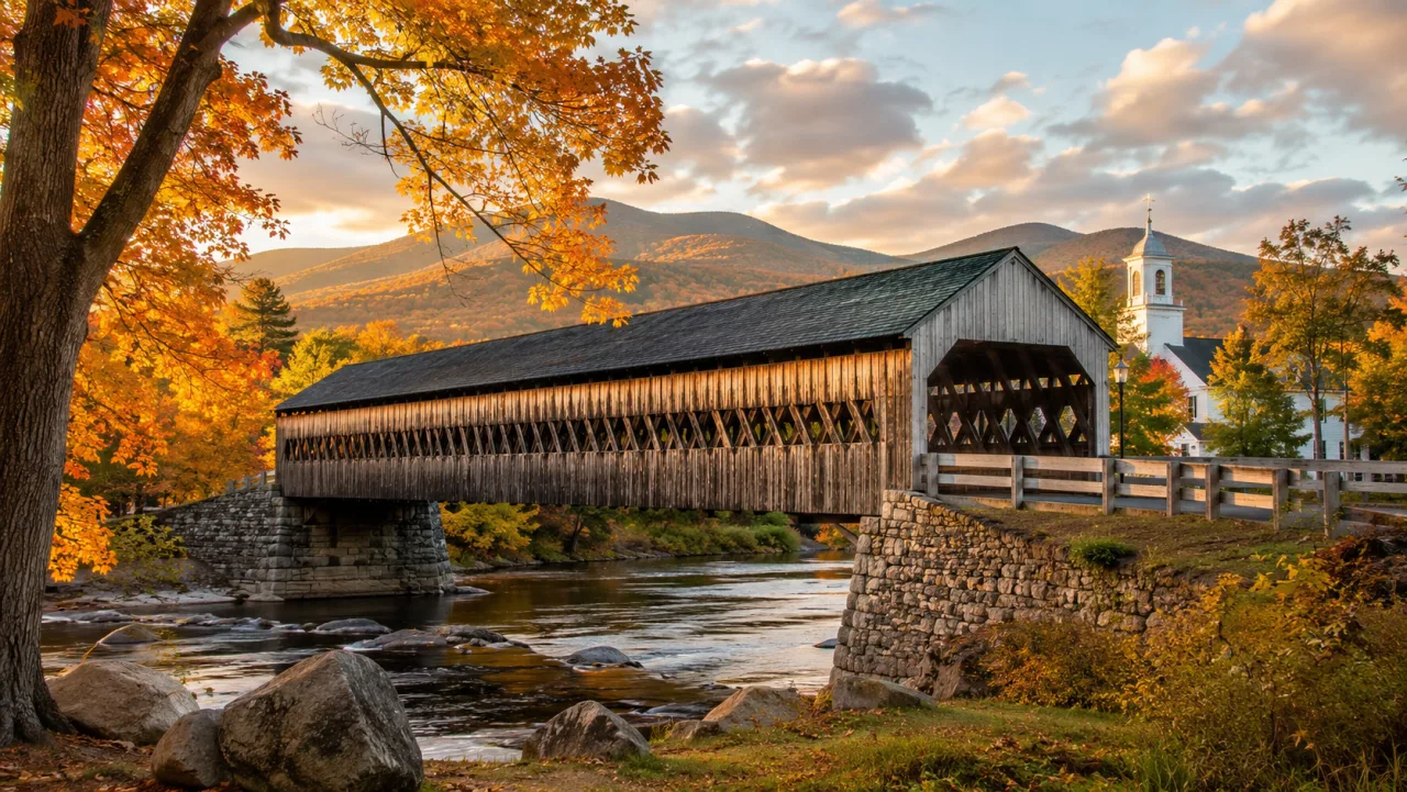
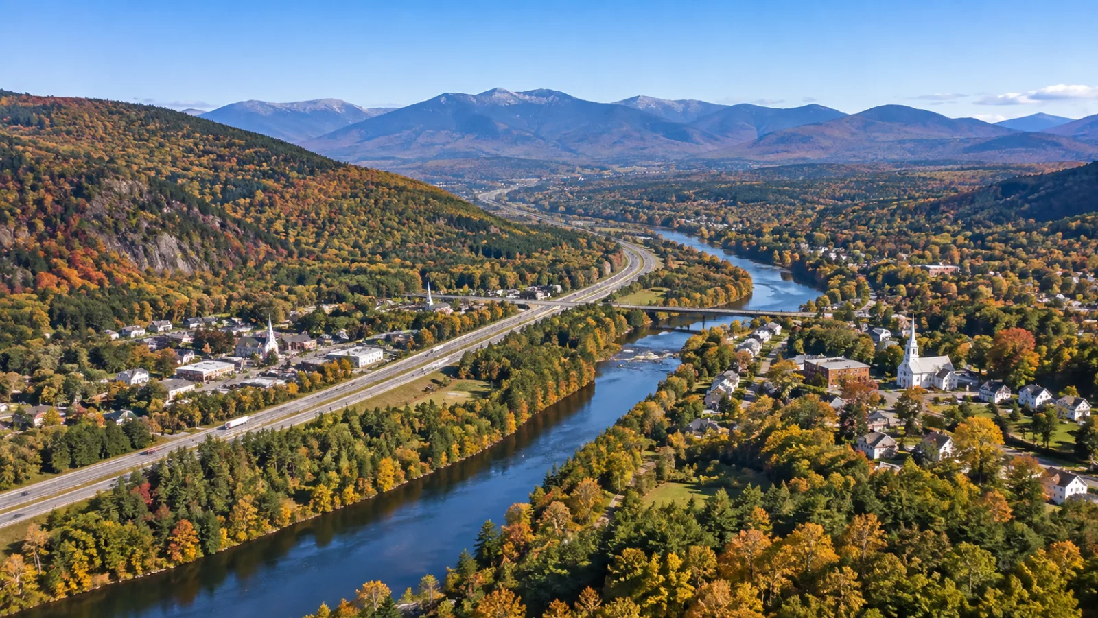
Campton is a town of villages rather than a single center, and the names on the map still mean something. Campton Lower Village and Campton Upper Village line Route 175 and the Pemigewasset on the east side of I-93; Campton Hollow follows the Beebe River into the hills to the east, where the Turkey Jack covered bridge crosses the river; West Campton climbs the hillside across the Pemi; Blair, on the river between the two interstate exits, carries the Blair covered bridge, one of the longest covered bridges entirely within New Hampshire; and Beebe River is the former mill village on the river of the same name.
Housing follows the same pattern: village homes near the crossroads, riverside camps along the Pemi and the Mad, hillside farmhouses with acreage, and newer construction climbing toward Waterville Estates. Most properties outside the village-district water systems run on private wells and septic — normal here, and worth understanding before you buy or build. Our Campton NH real estate page sorts the current inventory by type, price band and ZIP code.
Living in Campton
Waterville Estates and the Owl's Nest Side of Town
Two communities inside Campton explain a large share of the town's real estate. Waterville Estates is a mountainside community of roughly 700 homes and condos in the hills above the Mad River valley, with a structure most newcomers haven't seen before: owners belong to both the Waterville Estates Association and the Waterville Estates Village District, a real taxing entity that maintains the roads and a recreation campus — indoor and outdoor pools, hot tubs, the Community Center and the Estates' own ski hill at Campton Mountain — and that runs the community water system, funded by its own semiannual water rates rather than by the district tax. Our Waterville Estates guide covers the fees, the district tax and the rental rules in detail.
On the other side of town, roughly half of Owl's Nest Resort — the four-season golf community built around New Hampshire's only Nicklaus Design championship course — sits on the Campton side of the Campton–Thornton line, with the clubhouse campus and the Lake Harold beach club carrying a Thornton address. Single-family homes, townhomes and homesites in a resort setting, minutes from Exit 28: we know it house by house, because our office is on the way in.
Living in Campton
Things to Do, Season by Season
Start with the water. Livermore Falls, where the Pemigewasset drops through a rocky gorge on the Campton–Plymouth line, is the local swimming hole of record on a July afternoon; the Mad River runs cold and clear the length of Route 49, fly-fishing water in June and tubing water in August; and the Welch–Dickey Loop, the best bang-for-effort summit hike in the region, starts a few minutes up Route 49. Add the covered bridges, the Beebe River logging corridor for walking and snowshoeing, golf at Owl's Nest and the White Mountain National Forest trailheads in the town's corners, and you can fill a season without driving more than fifteen minutes. Our things-to-do guide for Campton covers all of it.
Winter sets the rhythm: ski-Saturday traffic climbs Route 49 toward Waterville Valley from December through March, Loon is a straight shot north, and Waterville Estates runs its own small hill at Campton Mountain. Spring is honest mud season — April is for maintenance, town meeting and watching the rivers run high. Summer flips the town outdoors, and October foliage along Route 49 and over the covered bridges books the rental homes we manage solid. Nothing shutters in the shoulder seasons the way it can in resort centers: the school buses and plow trucks run regardless, and Plymouth's services are ten minutes away in every month.
Getting Here & Around Campton
Campton sits right on I-93 at Exits 27 and 28, which makes it one of the easiest White Mountains towns to reach and to get around from. Approximate drive times:
- Boston, MAAbout 2 hours — roughly 130 miles, almost all highway via I-93.
- Manchester–Boston Regional AirportAbout 1 hour south on I-93 — the closest airport for most trips.
- Boston Logan International AirportAbout 2 hours, straight down the interstate.
- Waterville Valley ResortAbout 15 minutes up Route 49 to the ski area and Town Square.
- Loon Mountain, LincolnAbout 20 minutes north on I-93 — the second ski option at the door.
- Plymouth (services & hospital)About 10 minutes south — groceries, Speare Memorial Hospital, and Plymouth State University.
Campton vs. Nearby Towns
Buyers weighing Campton usually compare it against its Route 49 corridor neighbors. Here's the quick read on each — follow a link for that town's full guide and listings.
Thornton
Just north on I-93 and home to the Owl's Nest clubhouse campus — a near-twin of Campton with the same two-mountain access, often a touch more rural.
Plymouth
Ten minutes south and the region's service hub: a real downtown, a university and a hospital. More year-round convenience, less resort quiet.
Waterville Valley
The resort village itself at the end of Route 49 — ski-in convenience and a walkable Town Square, at a higher price and mostly condos.
Around Campton NH
Schools, everyday places and nearby destinations near Campton
Source: Google Maps Platform (Places) and Owl’s Nest Real Estate — not PrimeMLS data.
Campton NH FAQs
What county is Campton NH in?
Campton is in Grafton County, New Hampshire, the large western county that also includes Plymouth, Thornton, Holderness and the other towns along the Pemigewasset River valley. Day to day the county matters less than the town: property taxes, permits and assessments run through the Town of Campton offices, while deeds are recorded with the Grafton County Registry of Deeds in North Haverhill.
What is the population of Campton NH?
Campton's population was 3,343 at the 2020 U.S. Census, spread across about 52 square miles of the Pemigewasset and Mad River valleys. The count understates who is actually in town on a given weekend: between Waterville Estates, the Owl's Nest side of town and the vacation-rental calendar, ski weeks and summer Saturdays feel considerably busier than the year-round number suggests.
What is Campton NH known for?
Campton is known as the gateway to Waterville Valley — Route 49 leaves I-93 at Exit 28 here and climbs eleven miles to the lifts — and for Owl's Nest Resort & Golf Club, roughly half of which sits on the Campton side of the Thornton line. Locally it is also known for the Blair covered bridge over the Pemigewasset, Livermore Falls, the Welch–Dickey Loop trailhead and Waterville Estates, the mountainside community with its own ski hill at Campton Mountain.
What is there to do in Campton NH?
Swim at Livermore Falls on the Pemigewasset, drive or photograph the Blair covered bridge, fish and tube the Mad River, hike the Welch–Dickey Loop just up Route 49, walk the old Beebe River logging corridor, golf the Nicklaus Design course at Owl's Nest Resort, and ski Waterville Valley or Loon, each about twenty to twenty-five minutes away. Waterville Estates adds its own recreation campus with pools and the Campton Mountain ski hill for residents and their guests.
How far is Campton NH from Boston and the ski areas?
Boston is about two hours south via I-93 in normal traffic, and Campton is served directly by Exits 27 and 28, so there is no two-lane crawl at the end of the drive. Waterville Valley's lifts are eleven miles up Route 49, about twenty minutes; Loon Mountain in Lincoln is roughly twenty-five minutes north on the interstate; and Plymouth's hospital, university and grocery stores are about ten minutes south.
What are the schools in Campton NH?
Campton Elementary School on Route 175 serves the town from kindergarten through grade 8, and students continue to Plymouth Regional High School, about ten minutes south — all within SAU 48, the school administrative unit centered on the Pemi-Baker region that also serves Plymouth, Thornton, Holderness and Waterville Valley. Our Campton real estate page links the district page with the schools and the homes currently for sale near them.
Keep Reading
Campton NH Guides & Articles
October 31, 2026
Campton NH History & Landmarks: Covered Bridges, Livermore Falls and the Old Villages
October 30, 2026
Campton Lower Village and the Villages of Campton, NH
September 19, 2026
Plymouth vs Campton vs Thornton NH: Which Town Should You Buy In
September 14, 2026
Selling a House in Campton NH: The 2026 Seller's Guide
August 11, 2026
Things to Do in Campton NH Through the Year

July 31, 2026
Is Campton NH a Good Place for an Airbnb?
Living in Campton
Ready to Look at Homes in Campton?
40 homes for sale in Campton right now, median asking $512,450.