
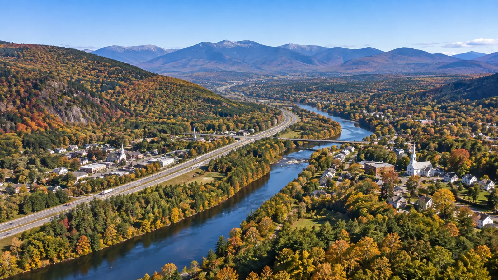

Campton Lower Village is the small settlement on NH Route 175 just south of the Route 49 traffic lights in Campton, New Hampshire — one of six named villages that make up the town, not a separate town and not a listed historic district. Campton has no single downtown: the U.S. Geological Survey and the town's own records count Campton Lower Village, Campton Upper Village, Campton Hollow, Blair, West Campton and Beebe River as distinct places, strung along Route 175 on the east bank of the Pemigewasset River and Route 3 on the west, with Interstate 93 between them at exits 27 and 28.
Our office sits at 399 NH Route 49, a few hundred yards from where the Lower and Upper villages meet, so this is the map we draw for buyers who find a listing described as "Campton Hollow" or "West Campton" and want to know what that means on the ground. For the whole town, start with Living in Campton NH and the Campton NH real estate hub; this is the village-by-village layer underneath.
The villages of Campton at a glance
Campton covers 52.5 square miles of the Pemigewasset valley and the hills on either side, from the Holderness line in the south to Thornton in the north. The villages grew up where roads met rivers:
- Campton Lower Village — Route 175, just below the Route 49 lights.
- Campton Upper Village — Route 175 north of Route 49, around Campton Pond and the Mad River dam.
- Campton Hollow — Route 175 south, 3.7 miles from the lights, where the Town House and Congregational Church stand.
- Blair — the Blair Road crossing of the Pemigewasset, with the covered bridge, at I-93 exit 27.
- West Campton — the Route 3 side of the river, west of I-93.
- Beebe River — the 1917 mill village where the Beebe River meets the Pemigewasset.
The "Campton Village" of older maps and casual conversation is really the pair of villages at the Route 49 and Route 175 junction — the Lower Village and the Upper Village — rather than a seventh place.
Campton Lower Village
The Lower Village is the first stretch of Route 175 south of the lights at Route 49, on the east side of the Pemigewasset and roughly half a mile from the Upper Village. The USGS places it at 43.859° N, 71.633° W, a short walk from Campton Pond and a few minutes' drive from I-93 exit 28.
Searches for a "Campton Lower Village Historic District" turn up nothing because there isn't one. The only Campton properties on the New Hampshire State Register of Historic Places are the Blair Covered Bridge (listed July 27, 2009) and the Norman and Marion Perry House on Ellsworth Hill Road (listed 2011, and on the National Register in 2012). The Lower Village's historic character — older frame houses on village lots along Route 175 and the side roads — is kept by its owners, not by a district designation.
Housing here: village homes on smaller lots close to the road, a scattering of newer houses on the side roads, and the occasional riverside parcel. It is the most walkable corner of Campton and the closest to the highway. Inventory changes weekly, so check the live Campton listings rather than any price we could print here.
Campton Upper Village and Campton Pond
The Campton Historical Society's marker for the Upper Village "generally identifies the area from Route 49 northward on Route 175," taking in Owl Street, Osgood Street and Mad River Road (Campton Historical Society site markers). Its centerpiece is Campton Pond, where the Mad River — which runs 17.9 miles beside Route 49 from Waterville Valley — settles out behind a small hydroelectric dam before dropping into the Pemigewasset floodplain.
Housing here: the village core along Route 175 and the streets above it, plus hillside homes climbing toward the Mad River valley. Because Route 49 begins here, the Upper Village is the natural base for anyone whose weekends point at Waterville Valley.
Campton Hollow
Drive 3.7 miles south on Route 175 from the lights and you reach the Hollow, the town's historic civic center. The Town House, an 1855 building with a Grange hall and carriage shed, houses the Campton Historical Society's collections and still hosts town hearings. Next door, the Campton Congregational Church sits on Route 175 "just north of Blair Road," which is how the Hollow connects to the next village. The Beebe River reaches Route 175 here on its way to the Pemigewasset.
Housing here: farmhouses and older capes on larger village lots, with open fields and the river close by. More acreage than the Lower Village, more distance from the highway.
Blair and the Blair covered bridge
Blair is the crossing. Blair Road leaves Route 175 at the Hollow, crosses the Pemigewasset on the Blair Bridge — a 292-foot, 10-inch Long-truss covered bridge built by Hiram W. Merrill in 1870 after an arsonist burned the 1829 original, rebuilt after Tropical Storm Irene and reopened in 2015 — and meets U.S. Route 3 and I-93 at exit 27, which the interstate signs for "Blair Bridge, West Campton" (I-93 exit list). The full story of the bridge, its arsonist and the town's two other covered bridges is in our Campton NH history and landmarks guide.
Housing here: homes along Blair Road on both banks, some with river frontage, with the Blair State Forest nearby. A Blair address means a covered bridge on the daily commute and exit 27 two minutes away.
West Campton and the Route 3 corridor
West Campton is the Route 3 side of the river — the strip between the Pemigewasset and the hills to the west, served by both exit 27 and exit 28. Route 3 was the main road north before I-93, and the campgrounds and motels along it still serve the through-traffic. Livermore Falls, the gorge the Pemigewasset drops through on the Campton–Holderness–Plymouth line, is reached from the Campton side by a trail off Route 3; our things to do in Campton NH guide covers the falls and the swimming rules.
Housing here: year-round homes on Route 3 and the roads climbing west of it, older camps along the river, and larger wooded parcels in the hills. Buyers who want quick highway access without living beside the Route 49 traffic often end up here.
Beebe River: the company village
Beebe River is the one Campton village that was built on purpose. In 1917 the Woodstock Lumber Company built a sawmill and a complete village — 18 houses, a boarding house and a general store — at the confluence with the Pemigewasset in eight months (Laconia Daily Sun, June 2019). Draper Corporation ran it as a bobbin mill from the mid-1920s until the hardwood ran out in the 1930s.
Housing here: the original mill bungalows are still lived in, by owners and renters, in a compact grid beside the abandoned mill buildings. It is the most distinctive streetscape in Campton and one of the few places in the White Mountains where you can buy a piece of a company town.
How the villages connect to Route 49, I-93, Waterville Estates and Owl's Nest
Two highway exits serve the whole town. Exit 27 lands you at Blair and West Campton on Route 3; exit 28 is Route 49, which runs east through the Upper Village lights and up the Mad River 11 miles to Waterville Valley. Everything else radiates from that crossing:
- Waterville Estates, the roughly 700-home amenity community with its own Campton Mountain ski hill, sits in the hills above Route 49 east of the Upper Village, partly in Thornton.
- Owl's Nest Resort spreads across the Campton–Thornton line off Route 49 near exit 28, which is also where you'll find our office.
- Plymouth, with the hospital, the university and the grocery stores, is one exit south of Blair — ten to fifteen minutes from any village in town.
Once you have picked a corner, our Campton and Thornton buyers' guide covers taxes, wells, septic and the rest of the hill-country homework.
Frequently asked questions
Where is Campton Lower Village?
On NH Route 175 on the east bank of the Pemigewasset River, immediately south of the Route 49 traffic lights in Campton, NH — about 43.859° N, 71.633° W per the USGS, roughly half a mile from Campton Upper Village and a few minutes from I-93 exit 28.
Is Campton Lower Village a historic district?
No. Campton has no listed historic district on the state or national registers. Its two listed properties are the Blair Covered Bridge (NH State Register, 2009) and the Norman and Marion Perry House on Ellsworth Hill Road (State Register 2011, National Register 2012).
What is the difference between Campton Upper Village and Lower Village?
Route 49. The Upper Village is the area north of the Route 49 junction on Route 175, around Campton Pond and the Mad River dam; the Lower Village is the stretch of Route 175 south of the junction. Together they are what most people mean by "Campton village."
How many villages are in Campton, NH?
Six named villages: Campton Lower Village, Campton Upper Village, Campton Hollow, Blair, West Campton and Beebe River. Waterville Estates and Owl's Nest Resort are planned communities within the town rather than historic villages.
Which I-93 exit is Campton?
Exits 27 and 28. Exit 27 is U.S. Route 3 for Blair Bridge and West Campton; exit 28 is NH Route 49 for Campton village and Waterville Valley.