
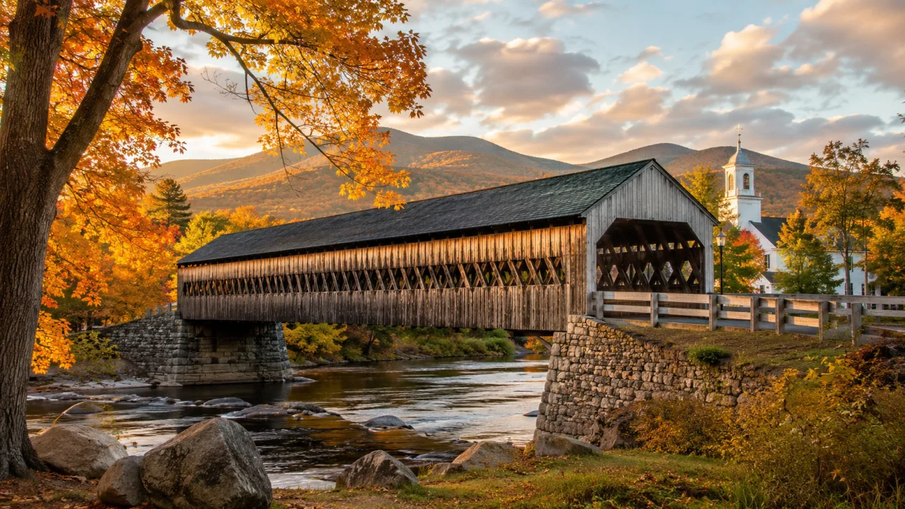

Campton, New Hampshire was granted by Governor Benning Wentworth in 1761, first settled in 1765 and incorporated in 1767, and its landmarks are the three covered bridges — Blair, Bump and Turkey Jim's — Livermore Falls on the Pemigewasset, the 1855 Town House in Campton Hollow and the 1917 company village at Beebe River. The town is the gateway to Waterville Valley: NH Route 49 leaves Interstate 93 at exit 28 in Campton and follows the Mad River 11 miles to the ski resort, which is why most of what passes through the town has been passing through for 250 years.
This is the version we can stand behind: every date below has a source linked beside it, and the one "landmark" we could not confirm — the Amity House that keeps appearing in search results — gets an honest answer at the end. For the present-day town, see Living in Campton NH and the Campton NH real estate hub.
How Campton began: 1761, 1765 and 1767
Governor Benning Wentworth granted Campton and neighboring Rumney in 1761 to Jabez Spencer of East Haddam, Connecticut. Spencer died before the charter's settlement terms were met, two families named Fox and Taylor became the first settlers in 1765, and Governor John Wentworth issued a fresh grant to Spencer's heirs and others in 1767 — the year the town counts as its incorporation. The name has nothing to do with anyone called Campton: according to the 1859 History and Description of New England, the proprietors built a camp here while surveying the two towns, and the camp named the town.
The villages that grew around the mills and river crossings — the Upper and Lower villages at the Route 49 lights, Campton Hollow, Blair, West Campton and Beebe River — are mapped in our companion guide to Campton Lower Village and the villages of Campton.
The Blair covered bridge
The Blair Bridge is Campton's best-known landmark and one of the longest covered bridges in New Hampshire: 292 feet, 10 inches, second-longest of those entirely within the state. It carries Blair Road over the Pemigewasset, linking Route 175 at Campton Hollow with U.S. Route 3 and I-93 exit 27, which is signed "Blair Bridge, West Campton."
The first bridge at the site went up in 1829. On July 28, 1869, a man named Lemuel Palmer drove a hay wagon onto it, unhitched his horse and set the hay alight; the bridge burned, and Palmer was tried and found not guilty because no one had seen him do it. Hiram W. Merrill of Plymouth built the replacement in 1870 for $3,350, using a Long truss with added arches — the state historical marker at the portal calls it the only surviving example in New Hampshire of Long's patented pre-stressing wedges.
Tropical Storm Irene damaged the bridge on August 28, 2011. Arnold M. Graton Associates of Holderness rebuilt it in 2014 at a cost of about $2.2 million, and it reopened in early 2015 with a six-ton limit. The bridge joined the New Hampshire State Register of Historic Places on July 27, 2009.
Bump Bridge and Turkey Jim's Bridge
Bump Bridge crosses the Beebe River on Bumps Intervale Road, south of Campton Hollow. The original queenpost bridge dated to 1877; when it could no longer be repaired, the town replaced it with the current 68-foot, 4-inch span in 1972, built under Arnold Graton and pulled into place by a crew that included local Boy Scouts. It carries cars only, with a three-ton limit.
Turkey Jim's Bridge — sometimes misremembered as "Turkey Jack's" — is a footbridge over West Branch Brook inside Branch Brook Campground off Route 49. A covered bridge first stood here in 1874; the present one was built in 1958, washed out in 1964 and restored in 2013.
Livermore Falls and the Pumpkin Seed bridge
A few miles downstream of Blair, the Pemigewasset narrows and drops through a granite gorge at Livermore Falls, on the line where Campton meets Holderness and Plymouth. Mills once used the drop for water power, and the ruins of an old paper mill and the coffer dam that fed it still sit on the riverbank. Above the gorge hangs the landmark everyone photographs: a wrought-iron lenticular-truss bridge, known locally as the Pumpkin Seed bridge, which the three towns commissioned from the Berlin Bridge Company of Connecticut in 1886 for $4,100 after a series of wooden bridges had washed away. It was closed in 1959 and has stood abandoned since.
The land around the falls has been public for a century: the state bought the first parcels in 1918 to create Livermore Falls State Forest and added more in 1992 to form the Livermore Falls Recreation Area, with the beach and parking on the Holderness side off Route 175 and a trail down from Route 3 on the Campton side. The gorge is a popular swimming spot and a dangerous one; our things to do in Campton NH guide covers the current access rules.
The Pemigewasset and the Mad River
Two rivers made the town. The Pemigewasset — the "Pemi" — starts at Profile Lake in Franconia Notch and runs 65 miles south through Lincoln, Woodstock, Thornton, Campton and Plymouth before joining the Winnipesaukee River at Franklin to form the Merrimack. Every Campton village sits on one bank or the other.
The Mad River is the reason Campton is the gateway to Waterville Valley. It rises at the Greeley Ponds in Mad River Notch, runs 17.9 miles through the resort and a corner of Thornton with Route 49 beside it the whole way, settles out in Campton Pond at the Route 49 and Route 175 lights, and drops past a small hydroelectric dam at Campton Upper Village into the Pemigewasset floodplain.
Campton Hollow: the Town House and the Congregational Church
The town's civic history lives 3.7 miles south of the lights on Route 175, in Campton Hollow. The Town House, an 1855 building that served as town hall, library and municipal court, got its tin walls in a 1910 renovation and a Grange hall extension in 1912; today it houses the Campton Historical Society's collections and still hosts town hearings. Beside it stands the Campton Congregational Church, organized in 1774 and moved to its present site near the Town House in 1858, with a bell donated by Sylvester Marsh (New Hampshire Magazine, 2018). Marsh, born in Campton in 1803, is the engineer who built the Mount Washington Cog Railway; the town's other names in the history books are U.S. senator Henry W. Blair (1834–1920) and congressman Arthur Livermore (1766–1853).
Beebe River: a company village from 1917
In 1917 the Parker Young Company of Lincoln bought a 22,000-acre tract on the river, and its affiliate, the Woodstock Lumber Company, built a sawmill and an entire village at the confluence with the Pemigewasset in eight months (Laconia Daily Sun, 2019). Draper Corporation of Hopedale, Massachusetts bought the whole operation in the mid-1920s and converted the sawmill into a bobbin mill for its textile machinery. By 1935 the hardwood was gone and the railroad abandoned; the rails were pulled up for scrap in 1942. The bungalows are still occupied, and the mill buildings still stand beside them.
A modernist landmark: the Perry House
The Norman and Marion Perry House at 352 Ellsworth Hill Road, a circa-1960 modernist house designed by Hugh Stubbins, is the town's only property on the National Register of Historic Places, listed September 25, 2012 after joining the state register in 2011. It is a private home.
Gateway to Waterville Valley
Exit 28 and Route 49 make Campton the front door to Waterville Valley, and the second half of the 20th century added two planned communities to the old villages: Waterville Estates, the hillside community above Route 49 with its own Campton Mountain ski hill, and Owl's Nest Resort on the Campton–Thornton line, home to New Hampshire's only Nicklaus Design golf course. The practical comparison — taxes, district fees, wells and septic — is in our Campton and Thornton buyers' guide.
Frequently asked questions
When was Campton, NH founded?
Campton was granted in 1761 by Governor Benning Wentworth, first settled in 1765 and incorporated in 1767 under a new grant from Governor John Wentworth.
What is the Amity House in Campton, New Hampshire?
We could not verify that a historic "Amity House" exists in Campton. The name is not in the Campton Historical Society's site-marker guide, the New Hampshire State Register or the National Register, and the pages that use it are either content-farm "haunted house" stories or a college yearbook address. If you have a deed, photograph or family record connecting an Amity House to Campton, we would like to see it and will update this page.
How many covered bridges are in Campton, NH?
Three: the Blair Bridge (1870) over the Pemigewasset, the Bump Bridge (1972, replacing an 1877 bridge) over the Beebe River, and Turkey Jim's Bridge (1958, restored 2013), a footbridge over West Branch Brook inside Branch Brook Campground.
Can you swim at Livermore Falls?
The Livermore Falls Recreation Area is a state-run swimming and picnic spot on the Pemigewasset, with the beach and parking on the Holderness side. The gorge and the abandoned 1886 bridge above it are dangerous; check the current rules in our things-to-do guide first.
Is Campton Lower Village a historic district?
No. Campton has no listed historic district. Its registered properties are the Blair Covered Bridge (state register, 2009) and the Perry House on Ellsworth Hill Road (state register 2011, National Register 2012).