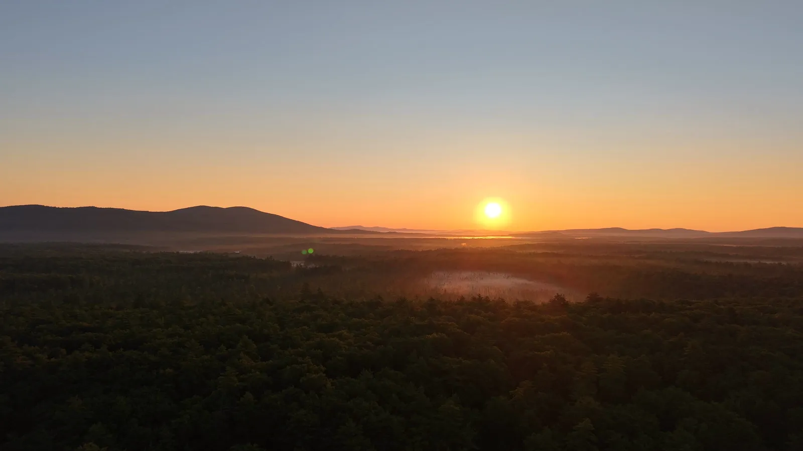

Ossipee, NH is a town of 4,372 people (2020 census) and the county seat of Carroll County, covering 75.3 square miles between the Ossipee Mountains and Ossipee Lake (Wikipedia). It is made up of six villages: Center Ossipee, Ossipee Corner, West Ossipee, Granite, Moultonville and Water Village. Routes 16, 25, 28 and 171 all run through town. As of August 2026, Zillow put the typical Ossipee home value at $427,393, and the 2025 property tax rate was $12.77 per $1,000, plus a village precinct tax that depends on where the house sits.
This guide is for people weighing a house, a lake place or land in Ossipee. It covers how the villages and the three ZIP codes split up, what Ossipee Lake and its bays are actually like, the public-access rules at the Ossipee Lake Natural Area, the Ossipee Pine Barrens, prices and taxes with dates and sources, and the state shoreland and septic rules every waterfront buyer runs into. It closes with the road and drive-time questions that decide whether a place works year-round.
Ossipee is on the eastern side of the region we cover from our offices in Campton and Plymouth. For the bigger picture, see our Lakes Region homes for sale page and our Lakes Region waterfront guide.
The town of Ossipee at a glance
| Fact | Ossipee, NH |
|---|---|
| County | Carroll (Ossipee is the county seat) |
| Population | 4,372 (2020 census) |
| Area | 75.3 sq mi, of which 4.8 sq mi is water |
| Villages | Center Ossipee, Ossipee Corner, West Ossipee, Granite, Moultonville, Water Village |
| ZIP codes | 03814 (Center Ossipee), 03864 (Ossipee), 03890 (West Ossipee) |
| State routes | 16, 25, 28, 171 |
| Rivers | Ossipee River, plus the Pine, Beech, Bearcamp and Lovell rivers |
| 2025 tax rate | $12.77 per $1,000, before precinct tax |
| Typical home value | $427,393 (Zillow ZHVI, August 2026) |
| School district | Governor Wentworth Regional School District |
Sources: Wikipedia, Ossipee, New Hampshire; NH DRA, 2025 municipal tax rates; Zillow Home Value Index; GWRSD.
The town of Ossipee is a working county seat as well as a lake town, and that shows. Year-round life here runs on Route 16, the main road between the Seacoast and the Mount Washington Valley. The town has a long local claim to fame too: Ossipee says it is the home of the first snowmobile, built in 1917 when Virgil D. White came up with a kit that turned a Ford Model T into a snow machine (Wikipedia).
Center Ossipee, Ossipee Corner and West Ossipee: the villages
When a listing says "Ossipee," it could be in any of six villages, and they feel different from each other.
- Center Ossipee (ZIP 03814). A census-designated place with 526 residents in 2020, on about a square mile of land southwest of Ossipee Lake and north of the Dan Hole River (Wikipedia). Routes 16 and 25 bypass the village to the east, so the old center is quieter than the highway suggests. It is the closest village to the lake's south shore, Broad Bay and the Natural Area.
- Ossipee Corner (ZIP 03864). The town's other main village, about 5 miles south of Center Ossipee at the junction of Routes 28 and 171, close to Route 16. It is shown simply as "Ossipee" on topographic maps and is home of the "Ossipee" post office (Wikipedia). In our MLS feed, 03864 is the ZIP on much of the town's inland, wooded and rural listings.
- West Ossipee (ZIP 03890). An unincorporated village near the town's northern boundary on Route 16, at an elevation of 433 feet, where Route 41 heads north toward Silver Lake and Madison and Route 25 heads west toward Tamworth and Moultonborough (Wikipedia). The Bearcamp River runs along its southwestern edge, and Nickerson Mountain, the site of the old Mount Whittier ski area, rises nearby.
- Granite, Moultonville and Water Village. Smaller settlements that most buyers know by road names more than village names.
West Ossipee, New Hampshire, and its 03890 ZIP code. West Ossipee has its own ZIP code, separate from Center Ossipee (03814) and the rest of town (03864) (Wikipedia). People often search "West Ossipee NH 03890" when they mean a Route 16 address, but in our MLS feed only a handful of Ossipee listings carry an 03890 ZIP. Most Ossipee property is listed as 03814 or 03864. The ZIP decides your mailing address. It does not decide your town tax rate or school district, which are the same across Ossipee. Your village precinct is a separate question, covered under taxes below.
Ossipee Lake: size, bays and depth
Ossipee Lake covers 3,257 acres, making it the sixth-largest lake located entirely in New Hampshire. It is 3.5 miles long and up to 2.3 miles wide, with a maximum depth of 73 feet, an average depth of 27 feet and a surface elevation of 407 feet (Wikipedia). The lake is split between the towns of Ossipee and Freedom.
What buyers usually call "Ossipee Lake" is actually a chain of four connected waters:
- Ossipee Lake, the big, open main basin.
- Broad Bay, reached through a winding channel from the main lake. It straddles the Ossipee–Freedom line.
- Leavitt Bay, downstream of Broad Bay.
- Berry Bay, in Freedom, where the Ossipee River begins.
All four sit at the same water level because a dam downstream at Effingham Falls controls them (Wikipedia, Broad Bay). The Danforth Ponds (Danforth Bay) sit to the north in Freedom. The lake is fed by the West Branch from the north, the Bearcamp and Lovell rivers from the west and the Pine River from the south. It drains through the Ossipee River, which flows east into the Saco River in Maine (Wikipedia). N.H. Fish and Game depth maps of the lake and each bay are posted by the Ossipee Lake Alliance.
Buyers should understand the difference between the main lake and the bays. The main lake has long views and big-water wind. The bays and the channel are calmer and more sheltered, with more boat traffic in the narrow sections. In summer the channel between the main lake and Broad Bay is busy. The sandbar at the S-curve of that channel, near Cassie Cove, has been a rafting spot since the 1950s. State rule Saf-C 407.04 limits rafts there to 10 boats, which must stay 50 feet from the main channel and leave by sunset (Ossipee Lake Alliance). A shorefront house near that stretch gets a different summer than one on a quiet cove, so visit on a July weekend before you buy.
The lake holds rainbow trout, lake trout, landlocked salmon, smallmouth and largemouth bass, pickerel, perch and bullhead (Wikipedia). For how it compares with Winnipesaukee, Squam and the rest, see our list of the best lakes in New Hampshire.
Public access: the Ossipee Lake Natural Area and Long Sands
Much of Ossipee Lake's shoreline is privately owned. The biggest public stretch is the Ossipee Lake Natural Area (OLNA), 400 state-owned acres at the south end of the lake on both sides of the Pine River. The N.H. Department of Natural and Cultural Resources, Division of Forests and Lands, manages it (DNCR brochure). Its shoreline is a sandy pond shore system made up of four rare natural communities, two of them globally rare, and the site is also an important archaeological site.
Boaters know this beach as Long Sands. Since the state fenced and posted the sensitive sections, only a designated public access area is open: about 1,000 feet of contiguous shoreline with a broad sandy beach and shallow water. The posted rules, per the DNCR brochure:
- Public use is limited to the designated access area, April 1 to November 30.
- The Natural Area is closed from sunset to sunrise.
- Motorboats must anchor offshore, afloat. Canoes and kayaks may land only in the designated landing area.
- Walking from the shoreline into the fen and bog is prohibited.
- No fires or grills on shore, no glass, and it is carry in, carry out. There are no restrooms.
- Boats must keep to headway speed within 150 feet of swimmers, other boats and the shore.
The rules are enforced. The Ossipee Lake Alliance reported that a $620 fine was issued in summer 2024 for trespassing in a closed section, and that Forest Rangers planned to patrol the area in 2025 (Ossipee Lake Alliance). Check with the Division of Forests and Lands (603-271-2214) before you go, because the state can change or end access if rare plants keep declining.
For trailered boats, Fish and Game's depth maps show a no-fee trailered launch on the Pine River off Route 25 that reaches the main lake and Broad Bay (N.H. Fish and Game map via Ossipee Lake Alliance). Our guide to public beaches in New Hampshire covers swimming beaches across the region.
The Ossipee Pine Barrens
East of the lake is one of the rarest landscapes in New England. The Nature Conservancy's Ossipee Pine Barrens Preserve protects 2,700 acres in Ossipee, Freedom, Madison and Tamworth. It has some of the roughly 2,000 acres of pitch pine and scrub oak barrens left in the Ossipee region, and nearly two dozen threatened or endangered moths and butterflies, plus whip-poor-wills and nighthawks (The Nature Conservancy).
The barrens sit on top of the Saco-Ossipee Aquifer, the largest in the state, which supplies drinking water to the surrounding towns. That matters for property, because the deep sandy soils that make the barrens drain fast also make shoreland septic setbacks stricter (more on that below).
There are three trailheads: West Branch on Route 41, Cooks Pond on Lead Mine Road, and Jackman Ridge on Ossipee Lake Road. The West Branch trailhead has a ¾-mile accessible trail and a 1.3-mile Pine Barrens Loop. Jackman Ridge has views over the barrens to the Ossipee Mountains and the lake. In all, the preserve has about 7.5 miles of trail (TNC map guide).
Things to do in Ossipee, NH
Ossipee's attractions are mostly outdoors, and most of them are free.
- Ossipee Lake and the bays for boating, paddling and fishing, with the Natural Area beach from April through November.
- The Pine Barrens trails for easy walks, birding and snowshoeing.
- Conner Pond (often spelled Connor Pond), Ossipee NH. An 85-acre coldwater pond off Pine Hill Road with a Fish and Game launch. Gas motors are banned, it is stocked with brook trout, and swimming is not allowed at the launch (Conway Daily Sun).
- Indian Mound Golf Club, Center Ossipee. A semi-private 18-hole, par-70 course on Route 16B, opened in 1968 (GolfPass). The Indian Mound neighborhood around it has its own homeowners' association, which shows up in MLS listings.
- The Whittier Bridge. An 1870 covered bridge over the Bearcamp River just west of West Ossipee and a rare surviving Paddleford truss. It is named for poet John Greenleaf Whittier, who summered nearby, and has been on the National Register of Historic Places since 1984 (Wikipedia).
- Snowmobiling. Fitting for the town that claims the first snowmobile. The Pine Barrens' West Branch Trail is a popular snowmobile route.
Things to do near Ossipee, NH: Wolfeboro's waterfront and Lake Wentworth are about 15 miles south. The Castle in the Clouds estate in the Ossipee Mountains is in neighboring Moultonborough. North Conway, the Kancamagus Highway and the Mount Washington Valley ski areas are up Route 16 to the north.
Ossipee NH real estate: prices and what is for sale
Home values. Zillow's Home Value Index puts the typical Ossipee home at $427,393 as of August 31, 2026, up about 2.9% from $415,311 a year earlier. Here is how the neighboring towns compare on the same index:
| Town | Typical home value, Aug 2026 | One-year change |
|---|---|---|
| Effingham | $338,235 | +3.1% |
| Tamworth | $386,841 | +7.1% |
| Ossipee | $427,393 | +2.9% |
| Freedom | $467,169 | +8.2% |
| Wakefield | $479,586 | +3.4% |
| Wolfeboro | $634,683 | +3.3% |
Source: Zillow Home Value Index (all homes, mid-tier, smoothed and seasonally adjusted), data through August 31, 2026.
What is listed right now. As of October 1, 2026, our PrimeMLS feed showed 40 active residential listings in Ossipee: 37 single-family homes, 2 condos and 1 mobile home. The median asking price was $525,000, and asking prices ran from $229,000 to $2.4 million. There were also 29 active land listings. Thirteen active Ossipee listings were waterfront, priced from $400,000 to $2.4 million. These are asking prices, not sales, and lake frontage drives the top of the range. That is why the median ask sits well above Zillow's typical value.
What the money buys. In our experience, Ossipee homes for sale fall into three groups:
- In-town and roadside homes in Center Ossipee, Ossipee Corner and along Routes 16, 25 and 28. These are year-round houses on town-maintained roads.
- Lake-association and back-lot homes around the lake and bays, many in subdivisions with shared beaches, docks or rights of way. If a listing says "deeded access" or "beach rights," read the association documents before you assume a boat slip comes with them.
- True waterfront on the main lake, Broad Bay, Leavitt Bay or the Pine River. This is where the $1 million-plus listings are. Examples in the current feed include homes in the Leavitt Bay South Shore Association and the Indian Mound Homeowner's Association.
Land is a big part of the real estate in Ossipee, NH. Much of the land for sale is wooded lots off the main roads. For how to judge a lot (septic approval, frontage, current use and road class), read our guide to buying land in New Hampshire.
To compare lake inventory across the state, browse New Hampshire lakefront homes for sale. Nearby lake towns with their own pages include Wolfeboro, Tuftonboro and Moultonborough. To the north is Conway.
Ossipee property taxes: the 2025 rate and precinct taxes
Ossipee's 2025 tax rate was set on December 18, 2025 at $12.77 per $1,000 of assessed value. The N.H. Department of Revenue Administration splits it into $3.69 municipal, $0.74 county, $1.12 state education and $7.22 local education (NH DRA, 2025 municipal tax rates).
Ossipee has a wrinkle most towns don't: three village precincts, each with its own tax. The DRA lists them as Center Ossipee Fire, Ossipee Corner Light and West Ossipee Fire. The precinct rate is added to the town rate, so two houses with the same value can get different bills. For the 2025 tax year, the DRA's village rate table set the precincts at $1.54 (Center Ossipee), $1.25 (Ossipee Corner) and $1.59 (West Ossipee) per $1,000, up from $1.33, $1.21 and $1.47 in 2024 (NH DRA, 2025 village district tax rates; 2024 village tax rates). Ask the selectmen's office which precinct a property is in.
A rough example. A home assessed at $427,000 pays about $5,453 at $12.77, plus about $534 (Ossipee Corner) to $679 (West Ossipee) in precinct tax at the 2025 precinct rates. That totals roughly $5,990 to $6,130 a year. Assessments don't always match market value, so use the property's actual assessment from the town card, not its price.
How that compares. Here are 2025 rates nearby, per the NH DRA: Freedom $7.39, Wakefield $8.71, Madison $8.98, Tamworth $14.78. Rates are not equalized, so a lower rate doesn't always mean a lower bill. Our explainer on New Hampshire property taxes shows how to compare towns properly.
Shoreland rules for Ossipee waterfront buyers
Every lot that touches Ossipee Lake, its bays, Conner Pond or any other public water of 10 acres or more falls under the state Shoreland Water Quality Protection Act (RSA 483-B). It regulates the 250 feet nearest the water:
- 50-foot primary structure setback. New houses must sit at least 50 feet back from the reference line.
- 50-foot waterfront buffer. Tree and shrub cutting in the first 50 feet is limited by a point system. You can't clear-cut a view.
- 150-foot natural woodland buffer. Between 50 and 150 feet, a quarter of the area must stay unaltered.
- Impervious surface. Roofs, driveways and patios are capped at 30% of the shoreland area, and anything over 20% needs a stormwater management plan.
- Permits. Most construction, excavation and filling within 250 feet needs an NHDES shoreland permit. Docks and anything built in the water are permitted separately by the NHDES Wetlands Bureau.
Older lake houses are often grandfathered. Many Ossipee camps sit closer to the water than today's rules allow. Under RSA 483-B:11 they are legal as they stand and can be repaired or replaced in kind. You can't move them closer to the water, and any expansion must leave the property more conforming than before. Know the footprint you're buying, because that footprint is what you'll be allowed to rebuild.
Septic is the big one around Ossipee. Since September 1, 2024, RSA 485-A:39 requires a licensed septic evaluation before the sale of developed waterfront property when any part of the system is within 250 feet of the water. A failed system must be replaced, generally within 180 days of the transfer. Replacement leach fields must sit at least 75 feet from the water, and 125 feet in fast-draining sand and gravel. Around Ossipee Lake and the Pine Barrens, sand and gravel is the common soil, so on a small lot the setback can decide whether a replacement system fits at all. Converting a seasonal camp to year-round use also needs septic approval under RSA 485-A:38.
Our guide to camps and cabins for sale in New Hampshire goes deeper on grandfathered camps and septic.
Seasonal vs. year-round roads
Many lake homes around Ossipee sit on private roads maintained by an association, and some sit on roads the town doesn't maintain at all. Before you fall for a cottage, find out:
- Who owns and plows the road. Town-maintained, private association or Class VI (a public road the town no longer maintains). A Class VI or unplowed private road can make a house seasonal in practice, whatever the house itself is built for. Our land buying guide explains the 2026 changes to building on Class VI and private roads.
- What the road association charges and whether there is a written maintenance agreement. Lenders and title insurers often ask for one.
- Whether the house is truly winterized. Look at the heat source, insulation, plumbing protected from freezing, and a well or water line that works in January. "Three-season" in a listing means exactly that.
- Spring conditions. Dirt roads soften in mud season, and towns can post weight limits that delay oil, propane and construction deliveries. Ask the neighbors.
Drive times from Ossipee
Ossipee sits at the junction of Route 16 (north-south) and Route 25 (east-west). The road mileages below are from Center Ossipee. Drive times are our rough estimates for normal traffic, and summer weekends on Route 16 run longer.
| Destination | Distance | Typical drive |
|---|---|---|
| Wolfeboro | ~15 mi | 25–30 min |
| North Conway | 27 mi | 35–45 min |
| Meredith | 28 mi | 40–45 min |
| Rochester | 36 mi | 45 min |
| Portland, ME | 53 mi | about 1 hr 15 min |
| Plymouth / Campton (I-93) | ~45–50 mi | about 1 hr |
| Concord | ~55 mi | about 1 hr 15 min |
| Boston | ~110 mi | about 2 hr |
Mileage sources: Wikipedia, Center Ossipee for North Conway, Meredith, Rochester and Portland; OpenStreetMap routing for the rest. For healthcare, Huggins Hospital is in Wolfeboro and Memorial Hospital is in North Conway. Ossipee is in the Governor Wentworth Regional School District, whose Kingswood Regional Middle and High Schools are in Wolfeboro (GWRSD).
Is Ossipee the right fit?
Ossipee costs less than the Winnipesaukee shore towns, and it has a large lake with real sand. It is close to the Mount Washington Valley without North Conway's prices. In return you get a working county-seat town on a busy highway, a precinct tax to factor in, and a lake whose busiest corners are crowded in July. If you're comparing it with the Squam and Newfound side of the region, our Squam Lake guide and Newfound Lake guide cover those lakes the same way. Our New Hampshire home buyer guide walks through the purchase itself.
When you're ready to look at Ossipee property, or want a second opinion on a shoreland or septic question before you make an offer, talk to our buyer team or contact us.
Frequently asked questions
What is the ZIP code for Ossipee, NH?
Ossipee has three ZIP codes. 03814 is Center Ossipee, 03864 is Ossipee (the Ossipee Corner post office and much of the rural part of town) and 03890 is West Ossipee. All three are inside the town of Ossipee, so the town tax rate and school district are the same. The village precinct and its tax depend on where the property sits.
Is Ossipee the county seat of Carroll County?
Yes. Ossipee is the county seat of Carroll County, New Hampshire. The town covers 75.3 square miles and had 4,372 residents in the 2020 census.
How big is Ossipee Lake?
Ossipee Lake covers 3,257 acres, the sixth-largest lake entirely in New Hampshire, with a maximum depth of 73 feet and an average depth of 27 feet. It connects through a channel to Broad Bay, Leavitt Bay and Berry Bay, which all share one water level set by the dam at Effingham Falls. The lake is split between Ossipee and Freedom.
Can the public use the beach at the Ossipee Lake Natural Area?
Yes, but only the designated public access area, about 1,000 feet of shoreline, from April 1 to November 30, and never between sunset and sunrise. Motorboats must anchor offshore, canoes and kayaks may land only in the designated area, and fires, grills and glass are banned. The rest of the 400-acre Natural Area is closed to protect rare plants, and the state has fined trespassers.
What is the property tax rate in Ossipee, NH?
The 2025 rate was $12.77 per $1,000 of assessed value, set in December 2025. Each of the three village precincts adds its own tax. In 2025 those were $1.54 (Center Ossipee), $1.25 (Ossipee Corner) and $1.59 (West Ossipee) per $1,000, per the N.H. Department of Revenue Administration. Check the property's precinct with the town before you estimate a bill.
Where is West Ossipee, NH?
West Ossipee is a village in the northern part of the town of Ossipee on Route 16, where Route 41 heads north to Madison and Route 25 heads west to Tamworth. Its ZIP code is 03890. The Bearcamp River and the 1870 Whittier covered bridge are just west of the village.
What are the shoreland rules for buying on Ossipee Lake?
The state Shoreland Water Quality Protection Act covers the 250 feet nearest the water. New houses must sit at least 50 feet back, cutting in the first 50 feet is limited, impervious surface is capped at 30%, and most work needs an NHDES permit. Since September 1, 2024, developed waterfront with a septic system within 250 feet of the water must also get a licensed septic evaluation before the sale.
Are there things to do in Ossipee in winter?
Yes. Ossipee claims to be the home of the first snowmobile (1917), and the Pine Barrens' West Branch Trail is a popular snowmobile route. People also ice fish on Ossipee Lake and snowshoe the Pine Barrens trails, and the Mount Washington Valley ski areas are up Route 16.