
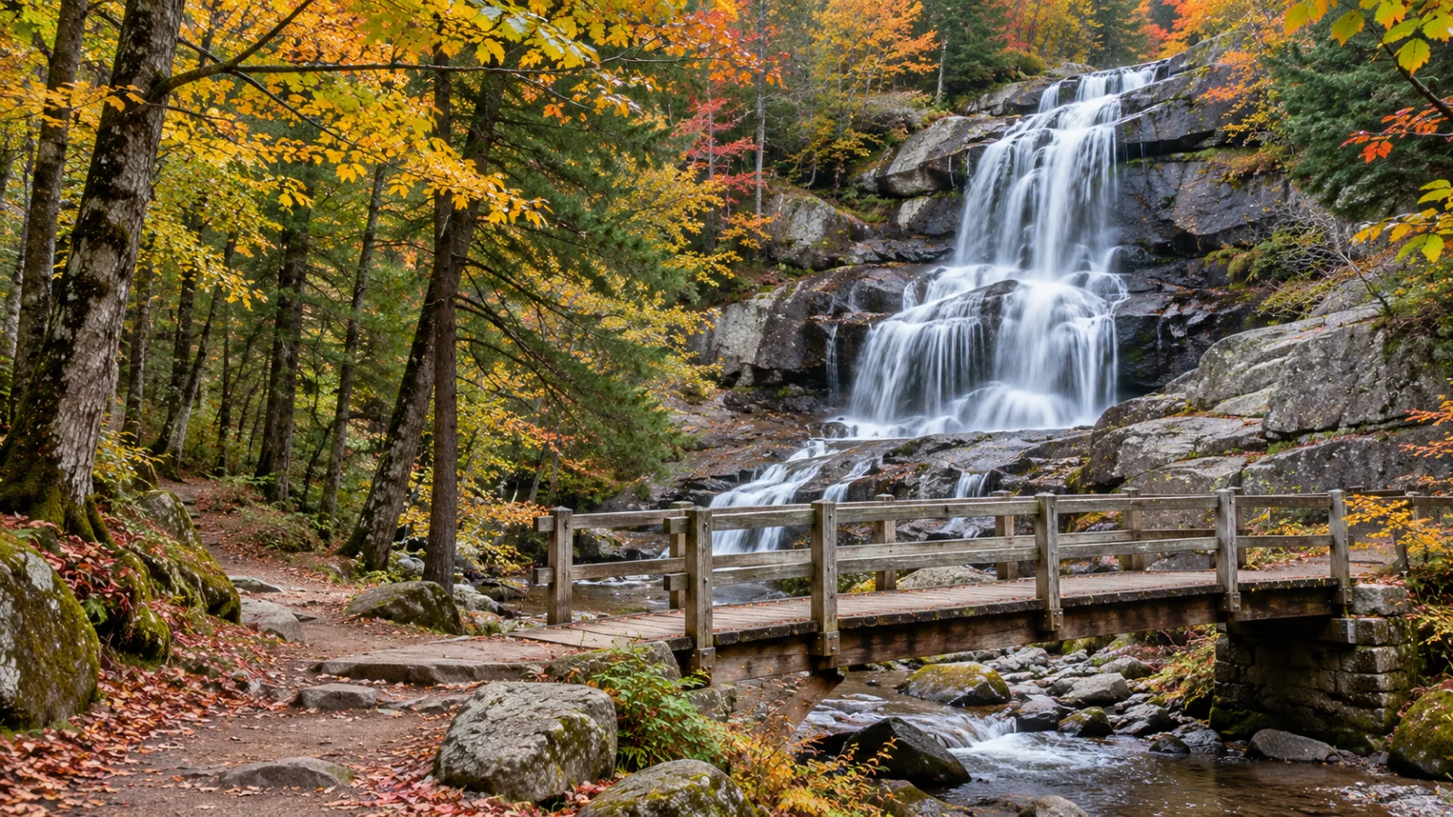

The best hikes in New Hampshire for most people are the short, open-ledge climbs of the White Mountains: the Welch-Dickey Loop in Thornton (4.4 miles, about 1,750 feet of gain), Mount Willard in Crawford Notch (about 3.2 miles round trip), Artist's Bluff in Franconia Notch (about 1.5 miles) and West Rattlesnake above Squam Lake (1.7 miles). The best White Mountains waterfalls are Arethusa Falls (about 140 feet), Diana's Baths, Sabbaday Falls, Glen Ellis Falls, Jackson Falls and the Flume Gorge. Many trailheads need a $5-a-day White Mountain National Forest pass.
We sell homes from an office in the Pemigewasset Valley, between Plymouth and Lincoln. That puts most of these trailheads within an hour of our desks, and it's why this list leans toward the hikes around Plymouth, Campton, Waterville Valley and Lincoln. The big-name hikes farther north and east are here too.
In this article
- White Mountains hikes and waterfalls at a glance
- Hikes near Plymouth and Campton
- Waterville Valley and the Welch-Dickey Loop
- Franconia Notch and Lincoln: the Flume, the ridge and the short classics
- Waterfalls in the White Mountains, NH: the Kancamagus, Crawford Notch and Jackson
- Hikes near Lake Winnipesaukee, NH
- Family hikes in NH: the easy ones
- Dog-friendly hikes in New Hampshire
- Winter hiking in the White Mountains
- Fall hikes in New Hampshire
- Parking passes and fees: what a White Mountains hike costs
- Hiking safety and the Hike Safe card
- Living near the trailheads
- Frequently asked questions
White Mountains hikes and waterfalls at a glance
This table lists the New Hampshire hiking trails we send people to most, with the figures from the sources linked in each section below. Round trips are out-and-back unless marked as a loop. A dash means we couldn't confirm a gain figure from a primary source, so we left it out rather than guess.
| Hike or waterfall | Area | Round trip | Elevation gain | Best season | Fee to park (2026) |
|---|---|---|---|---|---|
| West Rattlesnake | Holderness, Squam Lake | 1.7 mi | ~385 ft | Late spring to fall | None |
| Rattlesnake Mountain | Rumney | 2.6 mi | ~935 ft | Spring to fall | None |
| Stinson Mountain | Rumney | 3.6 mi | ~1,375 ft | Summer, fall | None |
| Welch-Dickey Loop | Thornton | 4.4 mi loop | ~1,750 ft | Summer, fall | $5 pass, year-round |
| Cascade Path | Waterville Valley | 3.0 mi | ~540 ft | Spring, summer | None |
| Fletcher's Cascade | Waterville Valley (Route 49) | 3.2 mi | ~710 ft | Spring, summer | None |
| Mount Tecumseh | Waterville Valley | 5.0 mi | ~2,280 ft | Summer, fall | None |
| Mount Osceola | Tripoli Road, Thornton/Livermore | 6.4 mi | ~2,070 ft | Summer, fall | $5 pass in season |
| Mount Pemigewasset | Franconia Notch, Lincoln | ~3.6 mi | — | Summer, fall | None |
| Artist's Bluff | Franconia Notch | ~1.5 mi loop | — | Fall | None |
| Flume Gorge | Franconia Notch | 2-mile loop | Stairs | May to late October | Ticketed (adults $18 online, $21 at the window, 2026) |
| Mount Willard | Crawford Notch | ~3.2 mi | — | Fall | — |
| Arethusa Falls | Crawford Notch | ~3.0 mi | — (steady climb) | Spring, after rain | — |
| Diana's Baths | Bartlett | ~1.2 mi | Flat | Summer | $5 pass |
| Sabbaday Falls | Kancamagus Highway | Short walk | Gentle | Spring to fall | $5 pass |
| Jackson Falls | Jackson | Roadside | None | Spring, summer | None |
| Mount Major | Alton | ~3 mi | — | Fall | None |
The rest of this guide goes area by area, starting closest to our office and working outward.
Hikes near Plymouth and Campton
The best hikes near Plymouth, NH are three short ones in Rumney and Holderness that most visitors drive past on the way to Franconia Notch: West Rattlesnake, Rattlesnake Mountain and Stinson Mountain. None of them charges for parking, and all of them have a real view.
West Rattlesnake, Holderness. The Old Bridle Path climbs 0.8 miles and about 385 feet from Route 113 to an open ledge above Squam Lake. It's the shortest big lake view we know of. The trails are on University of New Hampshire land and are maintained by the Squam Lakes Association, which closes them in mud season, usually April. On summer Sundays the roadside parking on Route 113 overflows, so come early. More on the town is on our Holderness page.
Rattlesnake Mountain, Rumney. The Forest Service calls it a short, steep trail of 1.3 miles to a summit loop over the Baker River valley. USGS puts the summit at 1,572 feet and the trailhead at about 640, so you climb roughly 935 feet. The trailhead is on Buffalo Road, past the Rumney Rocks climbing lots.
Stinson Mountain, Rumney. The Stinson Mountain Trail climbs 1.8 miles and about 1,375 feet from a three-car pulloff at the end of Doetown Road. The summit looks down on Stinson Lake, and the old fire tower's concrete footings are still there. Our Stinson Lake page covers the camps around the lake below.
For everything else to do in town, from Pike's Peak on Plymouth Mountain to the river, see our list of things to do in Plymouth, NH.
Waterville Valley and the Welch-Dickey Loop
The Welch-Dickey Loop in Thornton is the signature hike of the southern White Mountains. It's a 4.4-mile loop by the Forest Service's count, with about 1,750 feet of gain and more than half of it on open granite ledge above the Mad River valley. The Orris Road trailhead is a fee site year-round, and on summer and foliage weekends the lot is full by mid-morning.
Up Route 49 in Waterville Valley, the choices widen. Mount Tecumseh, the lowest peak on the AMC's list of New Hampshire's 48 four-thousand-footers, is about 5 miles round trip from the ski area lot. Mount Osceola on Tripoli Road has the better summit view. For waterfalls, the Cascade Path (3 miles, seven cascades) and Fletcher's Cascade (3.2 miles from the Drakes Brook trailhead) are the easy ones.
Waterville Valley has enough trails for its own guide, and we wrote one. Our Waterville Valley hiking guide has 18 trails with distances, the Tripoli Road gate dates and which lots fill first. The town page is Waterville Valley real estate.
Franconia Notch and Lincoln: the Flume, the ridge and the short classics
Franconia Notch State Park, just north of Lincoln, has the most famous hike in New Hampshire and several of the best short ones. I-93 narrows to a two-lane parkway here, and most trailheads are right off it.
The Flume Gorge is an 800-foot granite gorge with walls 70 to 90 feet high (Wikipedia). The Flume Trail is a 2-mile loop of boardwalks and stairs. It's run by NH State Parks, with timed tickets. In 2026 adults paid $18 online or $21 at the window. The gorge closed for the season on October 26, 2026 and reopens in May.
Franconia Ridge is the hike people mean when they say "best hike in New Hampshire." The classic loop climbs the Falling Waters Trail past a string of waterfalls, crosses the open ridge over Little Haystack and Mount Lincoln to Mount Lafayette, and comes down the Old Bridle Path. It's a long, steep, above-treeline day. Don't make it your first White Mountains hike. NH State Parks notes significant route changes on the Falling Waters Trail near Cloudland Falls as of September 22, 2026, with relocation maps posted on its Franconia Notch page. Check them before you go.
The short ones. Mount Pemigewasset is about 3.6 miles round trip from the Flume visitor center to a cliff-top view. You can see its "Indian Head" profile from Route 3. Artist's Bluff is a short, steep loop of about 1.5 miles above Echo Lake, with the most photographed view of Cannon in the notch. Just south of the Flume, Georgiana Falls is a free, lightly marked walk to a series of cascades.
From Lincoln itself, the flat Lincoln Woods Trail off the Kancamagus crosses a suspension bridge and follows an old logging railroad grade. Franconia Falls is about three miles in. Our things to do in Lincoln, NH guide covers the town, and the Lincoln real estate page covers the market.
Waterfalls in the White Mountains, NH: the Kancamagus, Crawford Notch and Jackson
The best waterfall trails in NH are mostly in the White Mountains, and the falls run hardest in spring snowmelt and after a good rain. They can thin to a trickle in a dry August. Most of the famous ones are a short walk from a paved road, which is why their lots fill first.
Sabbaday Falls and the Kancamagus Highway
Sabbaday Falls is the easiest waterfall trail in NH that's worth the stop. It's a short, gentle walk from a Kancamagus Highway lot to a narrow flume and pools, with no swimming. The lot is a National Forest fee site. Farther east on the Kanc, Lower Falls is the roadside swimming spot on the Swift River.
Arethusa Falls and Mount Willard, Crawford Notch
Arethusa Falls is about 140 feet tall by the AMC's estimate (Wikipedia), one of the tallest waterfalls in New Hampshire. The Arethusa Falls Trail is about 1.5 miles each way off Route 302, climbing steadily. It's the best "real hike to a real waterfall" in the Whites. Ripley Falls, nearby, is a shorter, steeper walk to a long sliding cascade.
In the same notch, Mount Willard is about 3.2 miles round trip on a steady, moderate grade, to a ledge looking straight down Crawford Notch (SectionHiker). For effort against view, we think Mount Willard is the best day hike in the White Mountains for a first-timer.
Diana's Baths, Bartlett
Diana's Baths is a chain of granite pools and small cascades off West Side Road in Bartlett, about 0.6 mile each way on a flat gravel path. It's a fee site, and the lot fills by mid-morning on summer weekends. Don't go after heavy rain, when the current in the pools is strong.
Jackson waterfalls, NH: Jackson Falls and Glen Ellis Falls
The Jackson waterfalls are two very different stops on either side of the village. Jackson Falls is on the Wildcat River along Carter Notch Road (NH 16B), a few hundred yards above the village center. The river drops over granite ledges and shallow pools right beside the road, so there's no hike at all. Glen Ellis Falls is north of Jackson on Route 16 in Pinkham Notch, a short walk down from a roadside lot. Our Jackson, NH guide covers the village and Pinkham Notch, including the trailheads for Mount Washington (6,288 feet).
Hikes near Lake Winnipesaukee, NH
The best hike near Lake Winnipesaukee is Mount Major in Alton. It's a 1,786-foot summit (Wikipedia) with an open top looking straight up the lake. The blue-blazed Mount Major Trail climbs about 1.5 miles over open ledges from the Route 11 lot. The lot fills early on fall weekends, so get there before 9. Our Lake Winnipesaukee guide covers the lake itself, and our Alton Bay guide covers the village below the mountain.
West Rattlesnake, above, is the Squam Lake equivalent, and shorter.
Family hikes in NH: the easy ones
The best family hikes in NH have a payoff at the end of a short, low-risk walk. In our experience, that payoff is a waterfall, a pond or a ledge. Five we suggest for kids:
- West Rattlesnake (1.7 miles), the shortest big view in the area.
- Diana's Baths or Sabbaday Falls, both flat or gentle walks to water.
- The Flume Gorge, with boardwalks and stairs (not for a stroller).
- The Cascade Path in Waterville Valley, with seven cascades in 3 miles.
- Lincoln Woods to whatever point the kids want to turn around.
Pick a hike where turning back early still feels like a win. On a waterfall walk, it does.
Dog-friendly hikes in New Hampshire
Most White Mountain National Forest trails are dog-friendly. The rule is that dogs must be leashed in developed areas (campgrounds, trailheads and picnic areas). Outside them, they must be leashed or under real voice control. On a crowded ledge trail like Welch-Dickey, that means a dog that actually comes back when called. Paid attractions like the Flume Gorge set their own pet rules, so check before you load the car. Carry water for the dog on open ledge in summer. Granite heats up.
Winter hiking in the White Mountains
Winter hiking in the White Mountains is a different sport. The short trails above become icy, the sun sets before 4:30 p.m. in December, and conditions above treeline can be dangerous in any month. Traction (microspikes at least), extra layers and a headlamp are the minimum, even on a two-hour hike.
The best winter hikes in New Hampshire for a first season are the short, sheltered ones. Mount Willard has a moderate grade and a big view. Artist's Bluff is short. West Rattlesnake is low. Lincoln Woods is flat and good on snowshoes. The Welch-Dickey ledges get slick and icy from late fall on, so save the loop for a day with good traction and better judgment. Before any winter hike near Mount Washington, check the Mount Washington Observatory's higher-summits forecast and be ready to turn back.
Fall hikes in New Hampshire
The best fall hikes in New Hampshire are the open-ledge climbs, where the view takes in a whole valley of color: the Welch-Dickey Loop in Thornton, Artist's Bluff above Echo Lake, Mount Willard in Crawford Notch and Mount Major above Lake Winnipesaukee. All four are marked "Fall" in the table above for that reason.
Fall is also when the lots fill fastest. On a foliage weekend, plan to be at Welch-Dickey or Mount Major before 9, or go midweek.
Parking passes and fees: what a White Mountains hike costs
Most of the White Mountain National Forest is free to hike, but a specific list of developed trailheads and recreation sites charges for parking. A White Mountain National Forest day pass is $5 per vehicle, sold at the site's pay station or through the Recreation.gov site pass listing. The Forest Service's pass order form lists an annual pass at $30, valid for a year from the month of purchase.
The White Mountain National Forest also sells a household annual pass. Check the Forest Service's passes page for its current price before you buy.
Interagency passes (America the Beautiful, Senior and Access) are accepted in place of a White Mountain pass. Welch-Dickey, Diana's Baths and most Kancamagus Highway stops are fee sites. Rattlesnake, Stinson and West Rattlesnake are free. State parks like the Flume Gorge charge their own admission. The Forest Service warns that a day pass doesn't guarantee a parking space, and cars parked outside marked areas can be ticketed and towed.
Hiking safety and the Hike Safe card
The most important hiking safety rule in New Hampshire is to plan for no cell service. NH Fish and Game, which runs search and rescue, says hikers should never rely on a signal in the backcountry. Download the map, tell someone your route and turnaround time, and carry a headlamp.
The hikeSafe Hiker Responsibility Code is posted at major trailheads by the Forest Service and NH Fish and Game. In short: know what you're getting into and carry the gear, leave your plans with someone, stay together, turn back when conditions call for it, and be ready to get yourself out of trouble.
The Hike Safe card is a voluntary card sold by NH Fish and Game through its hikeSafe site. The 2026 card costs $25 per person or $35 per family, per Fish and Game's 2026 notice, and it covers the calendar year through December 31. A cardholder isn't liable to repay the cost of a rescue, although Fish and Game notes a person can still be liable where their conduct meets the standard in RSA 206:26-bb. A current New Hampshire hunting or fishing license gives the same protection.
Black bears are common throughout the forest, so store food properly. Deer ticks are too, so do a tick check after every hike from late spring through fall.
Living near the trailheads
Most people who hike here every few weekends start to price a house near I-93. From Campton, Thornton or Lincoln, the Welch-Dickey Loop, Franconia Notch and the Kancamagus are all a short drive. Our comparison of Plymouth, Campton and Thornton covers how the towns differ on taxes and price. If you'd like to see what's for sale near the trails, browse White Mountains homes for sale; our buyer services page explains how we work.
Frequently asked questions
What is the best hike in New Hampshire?
The best-known hike in New Hampshire is the Franconia Ridge loop in Franconia Notch, a long, steep, above-treeline day over Little Haystack, Mount Lincoln and Mount Lafayette. For most people, the best hike is a shorter one with an open view: the Welch-Dickey Loop in Thornton (4.4 miles), Mount Willard in Crawford Notch (about 3.2 miles round trip) or West Rattlesnake above Squam Lake (1.7 miles).
What are the best waterfalls in New Hampshire?
The best waterfalls in New Hampshire are Arethusa Falls in Crawford Notch (about 140 feet), the Flume Gorge in Franconia Notch, Diana's Baths in Bartlett, Sabbaday Falls on the Kancamagus Highway, and Glen Ellis Falls and Jackson Falls near Jackson. Spring snowmelt and the days after a heavy rain are when they're at their biggest.
Do you need a pass to hike in the White Mountains?
You need a pass to hike in the White Mountains only at signed fee sites. A White Mountain National Forest day pass is $5 per vehicle, and the Forest Service's order form lists an annual pass at $30. Welch-Dickey, Diana's Baths and most Kancamagus Highway stops are fee sites. Many trailheads, including Rattlesnake and Stinson Mountain in Rumney, are free.
What is the easiest waterfall hike in the White Mountains?
Sabbaday Falls on the Kancamagus Highway and Diana's Baths in Bartlett are the easiest waterfall hikes in the White Mountains. Sabbaday is a short, gentle walk, and Diana's Baths is about 0.6 mile each way on a flat gravel path. Jackson Falls in Jackson needs no hike at all, since it runs beside Carter Notch Road.
What are good winter hikes in NH?
Good winter hikes in NH for beginners are short, sheltered trails with moderate grades: Mount Willard in Crawford Notch, Artist's Bluff in Franconia Notch, West Rattlesnake in Holderness and the flat Lincoln Woods Trail. Carry microspikes, extra layers and a headlamp. Check the Mount Washington Observatory's higher-summits forecast before going anywhere near treeline.
What are the best hikes near Plymouth, NH?
The best hikes near Plymouth, NH are Rattlesnake Mountain in Rumney (2.6 miles round trip), Stinson Mountain in Rumney (3.6 miles) and West Rattlesnake in Holderness (1.7 miles), none of which charges for parking. The Welch-Dickey Loop in Thornton is about 27 minutes from Plymouth, and Franconia Notch is a short drive farther up I-93.
What is the Hike Safe card?
The Hike Safe card is a voluntary card sold by NH Fish and Game. For 2026 it costs $25 per person or $35 per family and is valid through December 31. A cardholder isn't liable to repay the state's rescue costs, except where their conduct meets the standard in RSA 206:26-bb. A current NH hunting or fishing license gives the same protection.