
Hiking near Waterville Valley, New Hampshire is unusual among White Mountain destinations because almost every trailhead sits on one road. Route 49 runs roughly eleven miles east from I-93 exit 28 and dead-ends in a bowl ringed by 4,000-footers, passing on the way the most-climbed ledge loop in the state, two of the shortest routes to a 4,000-foot summit anywhere in New Hampshire, a pair of mountain ponds you can reach with a seven-year-old, and one of the hardest day hikes in the Whites. The Waterville Valley Resort Association counts about 125 miles of trail radiating from the valley floor and calls it the first network of hiking trails in the United States, which is a claim worth taking seriously: the Waterville Valley Athletic and Improvement Association has been cutting and clearing these paths since 1888.
One useful thing to know before anything else: the White Mountain National Forest supervisor's office and the Pemigewasset Ranger District both sit at 71 White Mountain Drive in Campton, (603) 536-6100. That is the number to call about a road, a closure or a trail condition, and it is a local call for everyone who lives along this corridor.
Every distance and elevation below comes from a maintainer or a federal dataset — Forest Service trailhead pages, WVAIA and Resort Association descriptions, summit elevations from the USGS Geographic Names Information System, and trail center lines published by the Forest Service and New Hampshire GRANIT in the USGS National Map. Where no maintainer publishes a gain figure, what is given is the plain trailhead-to-summit difference on USGS elevation data, labeled net. Nothing here comes from crowd-sourced GPS tracks, which routinely disagree with the maintainers by half a mile.
What follows is trail by trail: where each one starts, how long it actually is, what the ground is like underfoot, when to go, and where you will and will not find a parking spot on a Saturday in October.
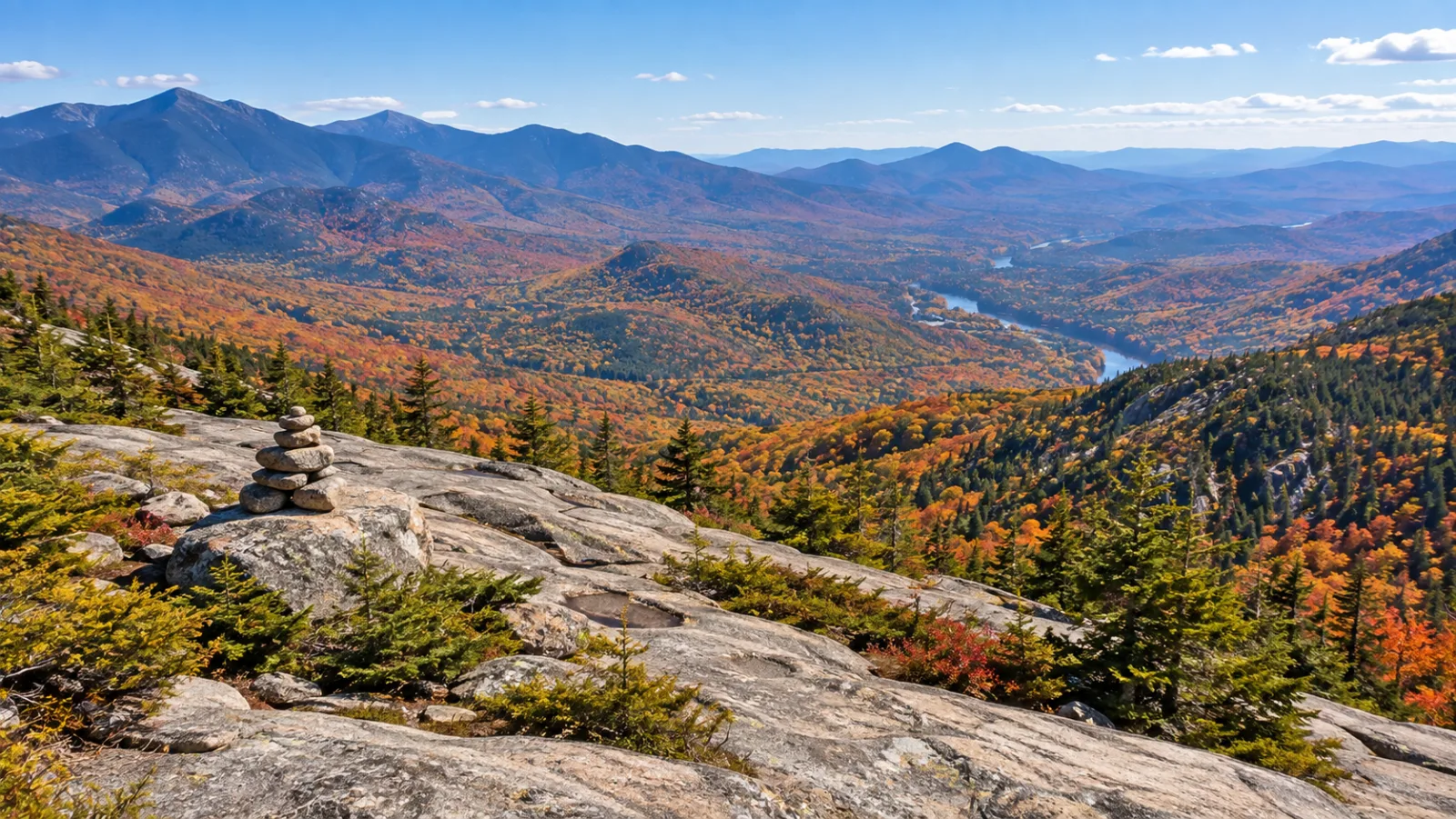
The valley at a glance
| Hike | Distance | Gain | Difficulty | Trailhead | Pass |
|---|---|---|---|---|---|
| Welch-Dickey Loop | 4.4 mi loop | ~1,750 ft | Moderate, exposed | Orris Rd, Thornton | $5/day |
| Mount Tecumseh | 5.0 mi round trip | ~2,280 ft | Difficult | Ski area lot | None |
| Mount Osceola | 6.4 mi round trip | ~2,070 ft | Moderate | Tripoli Rd | $5/day |
| Osceola + East Osceola | 8.4 mi round trip | — | Difficult | Tripoli Rd | $5/day |
| Sandwich Mountain | 7.8 mi round trip | ~2,570 ft net | Difficult | Rte 49, Drakes Brook | None |
| Greeley Ponds (north) | 3.4 mi round trip | — | Easy | Kancamagus Hwy | None |
| Greeley Ponds (valley) | 7.4 mi round trip | ~670 ft | Moderate | Depot Camp | $5/day |
| Mount Tripyramid loop | 10.2 mi loop | ~2,900 ft | Very difficult | Depot Camp | $5/day |
| Cascade Path | 3.0 mi round trip | ~540 ft | Easy | Snow's Mtn lot | None |
| The Scaur | 4.2 mi round trip | ~580 ft | Moderate | Depot Camp | $5/day |
| Goodrich Rock | 4.0 mi round trip | ~740 ft | Moderate | Depot Camp | $5/day |
| Smarts Brook pool | 2.2 mi round trip | ~230 ft | Easy | Rte 49, Thornton | None |
| Stinson Mountain | 3.6 mi round trip | ~1,375 ft net | Moderate | Doetown Rd, Rumney | None |
| Rattlesnake Mtn (Rumney) | 2.6 mi round trip | ~935 ft net | Steep, short | Buffalo Rd, Rumney | None |
| Mount Israel | 3.6 mi round trip | ~1,680 ft net | Moderate-hard | Mead Base, Sandwich | None |
| Morgan-Percival loop | ~4.5 mi loop | ~1,390 ft net | Hard | Rte 113, Holderness | None |
| West Rattlesnake | 1.7 mi round trip | ~385 ft net | Easy | Rte 113, Holderness | None |
Distances are Forest Service, WVAIA or Resort Association figures where those exist, and Forest Service or New Hampshire GRANIT trail center lines from the USGS National Map where they do not. Where two sources differ, both are named in the trail section below.
Welch-Dickey Loop, the one everybody comes for
The Welch-Dickey Loop is the signature hike of this corner of the Whites and the reason the Thornton trailhead lot is full by mid-morning on a summer Saturday. The Forest Service puts the loop at 4.4 miles over the summits of both Welch Mountain and Dickey Mountain; the Waterville Valley Resort Association measures it at 4 miles with about 1,751 feet of gain and calls it a two-to-four-hour hike. The Forest Service's own mapped center line for the loop measures 4.0 miles, which is why you will see both figures quoted. Either way, it is the best return on effort in the region, because more than half of it is spent on bare granite with nothing between you and the Sandwich Range.
One thing that surprises people on the ledges: Dickey is the higher mountain. USGS puts Dickey at 2,726 feet and Welch at 2,575, so the second summit of the loop is 150 feet above the first, even though Welch has the bigger view and gets the photographs.
The trailhead. From Route 49, turn onto Upper Mad River Road and then Orris Road; the large lot is signed, sits at 43.9046°N, 71.5890°W, and has a vault toilet and no drinking water. It is in Thornton, despite the Forest Service page listing it under Waterville Valley. Everything you need to carry, you carry in.
Which direction to hike it. Go counter-clockwise — right out of the lot, up the Welch Mountain Trail first. The WVAIA's own description says most hikers do it this way, and the reason is practical: you gain the Welch ledges in about 45 minutes and get the big Mad River valley view early, then take the steep ledge scrambling uphill rather than down. The descent off Dickey is a long, gentle walk through mature hardwoods on good footing, which is exactly what you want at the end.
Why exposure is the whole story. The Forest Service warns that the trail "follows numerous sections of exposed ledge and can be difficult in wet conditions," and that it passes through sub-alpine vegetation where staying on the rock matters. In practice: wet granite on the Welch summit cone is genuinely slick, ice makes the upper ledges a microspike-or-turn-back proposition from roughly November into April, and there is nowhere to hide if a thunderstorm builds. Afternoon storms in July and August are the single most common reason people get hurt here. Start early, be off the ledges by mid-afternoon, and treat a forecast with a thunderstorm in it as a reason to hike Smarts Brook instead.
Dogs, kids and water. Fit dogs do fine, but the ledge scrambles below the Welch summit involve two or three moves that a short-legged dog cannot make unassisted, and hot bare rock burns pads in August. There is no reliable water on the loop after the brook crossing at the start. Kids who are comfortable scrambling love it from about age eight; younger than that, the exposure above Welch Ledge is a real fall hazard.
Parking. The lot takes a recreation pass, $5 per vehicle per day, and it fills. On a foliage Saturday it is full by 8:30 and cars line the road shoulder, which is both illegal in places and how people get towed. Arrive before 8, or go on a weekday, or go at 2pm and accept that you will finish in the evening light — which, on these ledges, is the best time anyway.
Mount Tecumseh, the shortest 4,000-footer
Mount Tecumseh is 4,003 feet, the lowest of the 48 peaks on the Appalachian Mountain Club's New Hampshire Four Thousand Footer list, and the shortest of them to climb. The Forest Service puts the summit 2.5 miles from the trailhead — call it 5.0 miles round trip — and the Resort Association measures the standard out-and-back at 4.9 miles with 2,283 feet of gain, three to four hours.
The trailhead uses the Waterville Valley Ski Area parking lots, at the top end on the far right side. No Forest Service recreation pass is required, and there is no restroom and no water at the trail itself — but the lots belong to the ski area, so check with the resort before parking there on a ski day. The first fifteen minutes are gentle alongside Tecumseh Brook; the middle crosses the brook and climbs the northern foothills with the ski slopes visible left; and then, as the WVAIA puts it, "the next mile is straight up and rough and rocky." That mile is why the Resort Association rates the hike difficult despite its modest length. It is short, not easy.
Near the top, the Sosman Trail branches left and traverses the ridge past two lookouts — one east, one west and north — to the cell tower at the top of the ski area. Taking Sosman one way and the Tecumseh Trail the other is the better outing; the summit itself has limited views through the trees. The trail continues over the top and down the western side to Tripoli Road at 5.6 miles, which makes a traverse possible with two cars, but only in the months Tripoli Road is open.
Tecumseh is the 4,000-footer people in Campton and Thornton do after work in June, and for exactly that reason it is crowded — it is also the first summit most visiting families attempt. Go on a weekday if you can.
Mount Osceola and East Osceola, and the chimney
The Mount Osceola Trail from Tripoli Road is the finest summit view in the valley and, at 4,340 feet, the highest point around it. The Forest Service measures the summit at 3.2 miles from the trailhead and Osceola's East Peak — 4,156 feet, also on the 4,000-footer list — at 4.2 miles, with the trail continuing very steeply down to meet the Greeley Ponds Trail at 5.7 miles, just 1.4 miles from the Kancamagus Highway. The Resort Association's figure for the standard out-and-back to the main summit is 6.1 miles and about 2,070 feet of gain.
The trail itself is described by its maintainers as "heavily used, steadily ascending," and the first stretch is rockier and slower than the mileage suggests — budget more time than you think for the bottom third. It crosses a spring about two-thirds of the way up, then climbs in short steep switchbacks to the summit, which is the site of an old fire tower. The open ledge there looks straight down the valley at Tecumseh and the Sandwich Range.
The chimney. Continuing to East Osceola means dropping steeply into the col, and at one point the trail meets a short rock face where, in the WVAIA's words, hikers have "the option to 'chimney' down a short rock face, or take an easier route around." Take the bypass unless you are confident downclimbing; the rock is often wet. Allow an hour each way for the traverse to East Peak, which is a wooded summit marked by a small cairn — you go for the list, not the view, and the lookouts on the way up are the payoff. Coming back over it is steep, loose rock and ledge on a narrow ridge, and it is where tired people fall.
Access. The Osceola trailhead is a fee site, $5 per vehicle per day, with restrooms and no potable water, located off Tripoli Road between Waterville Valley and North Woodstock. The Forest Service does not maintain it in winter and does not charge a fee then, which tells you what you need to know about getting there between November and May.
The other way in. From the Kancamagus Highway you can walk the Greeley Ponds Trail 1.4 miles and climb East Osceola first. It is a harder, longer day and the descent off East Peak toward the ponds is the steepest sustained ground on either route. Most people who do it this way are traversing with a car shuttle.
Sandwich Mountain and Jennings Peak
Sandwich Mountain — Sandwich Dome on older maps — is the big wooded whaleback that fills the southern side of the Route 49 corridor, and Jennings Peak is the open ledge on its northwest shoulder that delivers the views the summit does not. Neither is on the 4,000-footer list, and both are better hikes than several peaks that are.
How high they actually are. The USGS Geographic Names Information System puts Sandwich Mountain at 3,983 feet and Jennings Peak at 3,442 feet. Published figures genuinely differ — the 52 With A View list, which counts both peaks, carries 3,960 and 3,440, and guidebooks in circulation round Sandwich to 3,980 or 3,993 — but every source agrees on the thing that matters for list-keeping: Sandwich Dome misses 4,000, by seventeen feet on the USGS number.
The Drakes Brook/Sandwich Mountain trailhead is on the east side of Route 49 about ten miles up from I-93 exit 28, a mile short of Waterville Valley, at 43.9383°N, 71.5114°W. It is open 24 hours, needs no recreation pass, and has no restroom and no water. The Forest Service notes that after the first half mile both trails are inside the Sandwich Range Wilderness, which changes the rules: group size is limited to ten people, no bikes or other mechanical transport, and blazing is deliberately minimal.
The Sandwich Mountain Trail crosses Drakes Brook immediately — usually awkward, genuinely dangerous in high water — then climbs straight up the flank of Noon Peak (2,963 feet), steep and rocky, to excellent northward views. Past Noon Peak it eases, passes an exposed ledge with a long view, meets the Drakes Brook Trail coming in from the left, and five minutes later reaches the Jennings Peak spur — about two tenths of a mile out to the ledge — on the right. The Forest Service puts the Sandwich Mountain summit 3.9 miles from the parking area; the WVAIA rates the whole thing difficult and says it is another hour from the Jennings spur to the top. The lot sits at roughly 1,415 feet, which makes the summit about 2,570 feet of net climb and Jennings about 2,030 — no maintainer publishes a gain for either, and the real total is higher because the trail gives a little back along the ridge.
Most locals do the loop: up the Sandwich Mountain Trail over Noon Peak, out to Jennings Peak, and down the Drakes Brook Trail, which meets the Sandwich Mountain Trail at 3.2 miles and returns along the brook on gentler ground. If you only want the view, turn around at Jennings and skip the summit entirely — it is wooded, with a large cairn and not much else. A spur off the Drakes Brook ski trail leads to Fletcher's Cascade, 3.2 miles round trip with about 710 feet of gain, which is a fine half-day on its own.
Greeley Ponds, the easy classic from either end
Two mountain ponds sit in Mad River Notch between Osceola's cliffs and Mount Kancamagus, and there are two entirely different ways to reach them.
From the north. The Greeley Pond trailhead on the Kancamagus Highway is a small lot at 44.0314°N, 71.5169°W with no fee and no facilities, and from it the ponds are 1.7 miles — about 3.4 round trip on gentle grades. This is the version to do with small children or a visiting parent. There is a beach at the north end of the upper pond.
From the valley. From the Livermore Road lot in Waterville Valley — known to everyone here as Depot Camp — the Resort Association measures the round trip at 7.4 miles with about 670 feet of gain, four to five hours. The trail leaves Livermore Road about ten minutes in, follows the Mad River past the Goodrich Rock Trail junction at roughly thirty minutes, crosses the river on a bridge, and climbs steadily up the notch. There is a river crossing near the top that the maintainers flag as difficult in high water, and the approach to the lower pond is reliably wet.
Greeley Ponds is a designated scenic area and a quarter-mile Forest Protection Area: no camping and no fires, anywhere near the water. Depot Camp is a fee site at $5 per vehicle per day, has restrooms, and is where nearly every long hike in the valley begins. Brook trout live in the ponds; a New Hampshire fishing license and a small rod are not a bad thing to carry.
Mount Tripyramid, honestly
The Tripyramid loop is, in the WVAIA's own words, "one of the most difficult hikes in the White Mountains." Ten and a fifth miles, about 2,900 feet of gain, five to seven hours if everything goes right, three summits — North Peak at 4,180 feet, Middle at 4,140 and South at 4,100 — and two bare rockslides. The whole route is inside the Sandwich Range Wilderness: no new blazing, ten hikers to a group.
The standard direction is up the North Slide and down the South Slide, and it matters. The North Slide is, per its maintainers, "straight up and very steep on slabs and ledge rock" — the recommended line starts on the left and angles toward the upper right corner where the trail re-enters the woods. Wet slab on the North Slide is how people get seriously hurt; a rainy forecast should cancel the loop, not modify it. The South Slide is steep but not precipitous and takes a descent better.
From Depot Camp you walk Livermore Road about 65 minutes to the South Slide trailhead and another 25 to the North Slide trailhead at a hairpin turn. There is also a way to skip the slides entirely: the Scaur Ridge Trail, which starts five minutes past the North Slide trailhead, climbs the opposite side of Avalanche Ravine on an old logging road with good footing, and joins the Pine Bend Brook Trail to the North Peak. That is the route for a group with mixed confidence, and nobody should feel bad about taking it.
The valley-floor network, where everyone actually hikes
This is the part of the Waterville Valley trail system that visitors underestimate and residents use every week. Almost all of it is WVAIA-maintained, gentle, and reachable from a paved parking lot.
- Cascade Path — 3 miles round trip, about 540 feet of gain, 1.5 to 2.5 hours, from the Snow's Mountain lot. Seven cascades on Cascade Brook with pools between them. You cannot park on Cascade Ridge Road; use the lot.
- Goodrich Rock Trail — 4 miles round trip, about 740 feet, roughly two hours. It threads the Davis Boulders, passes through a cave-like slot, and ends on top of the largest glacial erratic in the valley by way of a 20-foot ladder. The best hike here for kids who are bored of walking.
- The Scaur — 4.2 miles round trip, about 583 feet, via Livermore Road and Irene's Path to a rocky knob at 2,346 feet with a clean view of Tecumseh and the Sandwich Range.
- Waterville Flume — 5.4 miles round trip, about 1,190 feet, reached by continuing on Irene's Path. A small, remote cascade in a rock-walled slot, and one of the few places in this valley where you can be alone on an August afternoon.
- Snows Mountain Trail — a 3.9-mile loop with two lookouts down the Mad River valley. The maintainers call it "deceptively strenuous" and they are right; the ridge is a series of small ups and downs on rocky footing, and the lower section is hard to follow when the leaves are down.
- Elephant Rock Trail — a mile each way, about 800 feet, to the top of the old Snows Mountain ski area, often looped with the Greeley Ledges Trail.
- Big Pines Path — 1.8 miles round trip and essentially flat, off Livermore Road to four enormous white pines on the bank of the Mad River. Twenty minutes in from Depot Camp, five minutes long, worth it.
- Boulder Path — fifteen minutes from Depot Camp to a boulder sitting in the middle of Cascade Brook.
- Norway Rapids Trail — leaves Livermore Road about 45 minutes in and reaches a trough of deep water on Avalanche Brook that was the swimming hole of Waterville's first summer visitors. The brook crossing is almost always awkward.
- Mad River Path — a mile each way from Town Square along the river, with two long stairways. Impassable in winter and early spring at the stepping stones.
The WVAIA publishes no distance or elevation figures for Boulder Path, Norway Rapids or the Mad River Path, and no other maintainer does either; its own descriptions give walking times rather than numbers, which is why these three are described here in minutes. Treat any mileage you see for them online as somebody's GPS watch, not a surveyed figure.
The WVAIA also runs two patch programs that turn this network into a project: the Redliner 125, covering 19 peaks and all 125 miles, and the Pathfinder 70, a 45-trail, 70-mile list built for families. Both are the reason a lot of people here own a Waterville Valley trail map that is falling apart at the folds.
On maps. Cell coverage is gone the moment you leave the road, so carry paper. The WVAIA sells the Waterville Valley trail map, which is the only one that shows the connector paths and ski-trail junctions properly; the AMC's White Mountain Guide and map set covers the summits and everything beyond the valley. Download an offline map as a backup, not as your primary.
For everything in the valley that is not hiking — Town Square, the dining, the winter side — the Waterville Valley things-to-do guide and the four-seasons piece cover it, and the ski half belongs to our New Hampshire ski resorts guide.
Smarts Brook and the Tri-Town trails in Thornton
Halfway between Campton and Waterville Valley, about five miles up Route 49 from I-93 exit 28, the Smarts Brook trailhead sits on the south side of the road in Thornton at 43.8917°N, 71.5750°W. It is open 24 hours, has no recreation pass requirement and no restroom, and it is the single most useful trailhead in this corridor for a family, a dog, or a day when the weather is wrong for a summit.
The Smarts Brook Trail reaches a popular swimming hole about thirty minutes from the road — the Resort Association measures that as 2.2 miles round trip with 230 feet of gain. The pool sits inside a Forest Protection Area where camping and fires are prohibited. Keep going and the trail runs 5.1 miles to join the Sandwich Mountain Trail just below Jennings Peak, which makes a long, gradual back way onto the mountain.
The rest of the system is a set of interlocking loops on old logging roads, all rated easy: the Tri-Town Trail, which climbs steadily to a clearing at a height of land and returns; the Pine Flats Trail, which passes the Smarts Brook gorge and a locally rare stand of red and white pine; the Yellow Jacket Trail, which bridges the brook and links the two; and the Old Waterville Road, a thousand feet of trail connecting Pine Flats to the Six Mile Bridge lot. In winter this whole network is one of the best ungroomed cross-country ski areas in the region.
This is the network that makes living in Thornton or Campton different from visiting. It is a five-minute drive from most of the Route 49 corridor, it does not require a pass, and the lot is rarely full.
Mount Israel, Sandwich Notch and the Squam Range
Drive over Sandwich Notch Road — a narrow, unpaved, seasonal town road that leaves Route 49 in Campton and drops toward Sandwich village — and the crowds disappear. It is maintained by the Town of Sandwich and not maintained for winter travel at all; in the most recent full season on the Forest Service's road report it opened on 2 May 2025 and closed on 4 December 2025. It is slow going even in August, and it is the back door to a set of hikes that never see a queue.
Mount Israel, above Sandwich, is the classic reward — 2,628 feet, and the best view-to-crowd ratio in this guide. The Wentworth Trail starts at Mead Base on Diamond Ledge Road, about three miles north of Center Sandwich, and runs 1.8 miles to the summit — 3.6 miles round trip, and roughly 1,680 feet of climb from the 950-foot base. The reward is the whole Sandwich Range laid out across the valley, Whiteface, Passaconaway, the Tripyramids and Sandwich Dome in one sweep, usually with nobody else up there. Mead Base is run by the Friends of Mead Base Conservation Center, a volunteer non-profit; day use of the lot and grounds is free, it holds roughly thirty vehicles, and a donation in the box is the right thing to do. The Guinea Pond Trail off Sandwich Notch Road is the other way on, though sections flood from beaver activity and get temporarily rerouted.
South of there, the Squam Range in Holderness and Sandwich offers Mount Morgan (2,198 feet) and Mount Percival (2,178 feet), usually hiked as a loop from Route 113. The Squam Lakes Association, which maintains them, publishes no mileages, but the state's trail data does: the Mount Morgan Trail is 1.6 miles to the ridge junction, the Mount Percival Trail is 1.7 miles, and linking them along the Crawford-Ridgepole Trail with the short road walk between trailheads makes a loop of about 4.5 miles. Both trailheads sit around 800 feet, so each summit is close to 1,390 feet of climb. The SLA rates both trails hard — "steep slopes for extended periods over mostly uneven terrain" — so the modest elevations are misleading.
Two seasonal things the SLA states plainly and almost nobody repeats: the Morgan trailhead is plowed and used through the winter, and during mud season, usually April, the SLA closes its trails across both the Squam Range and the Rattlesnake networks — not just one trail. Do not treat an April closure sign there as advisory. Our Squam Lake area page covers what living on that side looks like.
West Rattlesnake at Squam is the shortest big view in New Hampshire: the Old Bridle Path climbs 0.8 miles and about 385 feet from Route 113 to an open ledge above the lake — call it 1.7 miles round trip. Parking is on Route 113 about 5.5 miles north of the Holderness town center, and it is the reason that stretch of road is chaos on a summer Sunday. Two points of confusion worth clearing up. The Squam Rattlesnakes are not Rumney's Rattlesnake Mountain — different town, different road, different mountain, and the Forest Service page for the Rumney one says so explicitly. And the Squam land is not Forest Service and not a land trust: it was given to the University of New Hampshire between 1965 and 1967 and is managed by UNH's Office of Woodlands and Natural Areas, with the Squam Lakes Association maintaining the trails.
Plymouth Mountain, between Plymouth and Holderness, is the local low-effort hill with a real view over the Lakes Region, and it is far quieter than either of the above. USGS puts the summit at 2,185 feet and the state trail data puts the trail at just under two miles one way. It is managed by the Town of Plymouth Conservation Commission and there is no fee. The access that is actually documented is Texas Hill Road out of downtown Plymouth, then right onto Old Hebron Road at a large boulder — not Pike Hill Road, which turns up in a lot of directions online. If you are making a day of the Plymouth side, our things to do in Plymouth guide has the rest of it, and Tenney Mountain is the other hill people ask about on that side of the river.
Rumney — Rattlesnake ledges, Stinson Mountain and the crag
Fifteen minutes west of Plymouth, the Baker River valley has two short hikes that punch far above their mileage and one world-class rock face.
Rattlesnake Mountain, Rumney. The Forest Service describes it plainly: a "short (1.3 miles) steep trail" — about two and a half miles round trip — to a scenic summit loop with excellent views over the Baker River valley. USGS puts the summit at 1,572 feet and the trailhead sits at about 640 feet, so it is roughly 935 feet of climb in 1.3 miles, which is why it feels far bigger than its mileage. The trailhead is on Buffalo Road, a couple of miles west of Rumney village and west of the Rumney Rocks day use area, and the Forest Service calls the parking "a small primitive parking lot for two or three vehicles." No fee, which is worth noting because the climbing lots on the same road do charge. An hour up if you are moving, and one of the best view-per-step ratios in the state.
The 2026 fire, and where it stands. A brush fire started on Rattlesnake Mountain on 13 August 2026; climbing access closed on 15 August, the fire was reported 100 percent contained on 17 August with crews still working hot spots deep in the mountain, the Rumney Rocks climbing area reopened on 21 August, and the Rattlesnake Trail and the Buffalo Pit and Rattlesnake parking areas reopened on 26 August. As of the start of September 2026 the White Mountain National Forest's alerts page carries no Rumney closure at all. Expect visible burn and loose, blackened footing where the fire ran; stay on the tread through it.
Stinson Mountain. The Stinson Mountain Trail climbs 1.8 miles to the summit — 3.6 miles round trip — with a good view over Stinson Lake, from a small pulloff at the end of Doetown Road with room for about three vehicles. No fee, no facilities. The Forest Service calls the summit 2,900 feet and the USGS names database has 2,887; the trailhead is at about 1,515 feet, which puts the climb at roughly 1,375 feet. Figures in circulation run from 1,350 to 1,450 and no maintainer publishes one, so treat 1,375 as a trailhead-to-summit difference rather than a surveyed total. A fire tower stood on the open summit for most of the twentieth century and its concrete footings are still there. This is the right mountain for a family working up to a 4,000-footer: real climbing, real view, no exposure, home by lunch. The lake below it is one of the prettiest in the state — see our Stinson Lake area page and the Rumney town page.
Rumney Rocks is climbing, not hiking. The Forest Service calls it "an international destination" with hundreds of rock and ice routes on schist, off Buffalo Road about a mile west of Rumney Center, with three parking lots "often filled to capacity on weekends." It is a $5-per-day fee site with a vault toilet, and it is managed under a published Forest Service climbing management plan. If you show up in hiking boots expecting a trail, you will find a short talus approach and a lot of rope. Two things worth knowing: much of the cliff is public land because the Rumney Climbers Association and the Access Fund bought it privately and handed it to the Forest Service — the last 86-acre tract transferred in February 2020 — and peregrine falcons nest here. In 2026 a closure covering the upper pitches of Main Cliff ran from the start of April through 1 August. It had expired by the time this was written, but the pattern recurs every spring, so read the kiosk before you rack up.
The recreation pass, what it costs and where it is required
Most of the White Mountain National Forest is free. A short list of developed trailheads is not, and around here the list is specific enough to memorize.
Current costs, re-checked in September 2026 against the Forest Service's own Welch-Dickey trailhead page (last updated 24 March 2026), its printed pass order form WM-6500-32, and a licensed White Mountain pass vendor:
| Pass | Cost | Notes |
|---|---|---|
| Day use | $5 per vehicle per day | Self-serve pay station at the site, or on Recreation.gov |
| Annual | $30 | Valid one year from the month of purchase |
| Annual household | $40 | Covers an individual or a two-car household |
The annual pass has moved to a digital format through Recreation.gov, so it can live in a phone wallet rather than on a windshield sticker, though the paper order form and the office counter still work. Interagency passes — the America the Beautiful annual pass, and the Golden Age and Access passes — are accepted at every one of these sites in place of a White Mountain pass. You can buy the annual pass at the Campton supervisor's office (cash, check or card), from local vendors, online, or by mailing the order form. The Forest Service also awards an annual pass to anyone who completes 16 hours of volunteer service on the forest, which is a genuinely good deal. Ninety-five percent of the fee revenue stays on this forest.
Where you need it in this corner. Welch-Dickey and the Livermore Road (Depot Camp) lot are fee sites year-round. The Osceola trailhead on Tripoli Road and Rumney Rocks II are fee sites in season but are not maintained — and charge nothing — in winter. Rumney Rocks proper is year-round.
Where you do not. Smarts Brook, the Drakes Brook/Sandwich Mountain trailhead, the Greeley Pond trailhead on the Kancamagus, the Mount Tecumseh trailhead in the ski area lot, Stinson Mountain and Rumney's Rattlesnake are all free.
Ten fee-free days are scheduled across 2026, including National Public Lands Day on 26 September and Veterans Day on 11 November. And note the Forest Service's own warning on the day pass: it "does not guarantee parking availability," and vehicles parked outside designated areas may be fined and towed.
Tripoli Road, and what happens when it closes
Tripoli Road runs from I-93 exit 31 in Woodstock over to Waterville Valley, and it is the access road for the Mount Osceola trailhead, the western Mount Tecumseh trailhead, and the roadside camping that made the road famous. The Forest Service runs the Tripoli Road Camping Area as a fee operation — $25 per vehicle per night at a single-family site, with a registration trailer two miles east of exit 31 — and gives its season as mid-May through October.
The actual gate dates. The Forest Service records the day each gate opens and closes on its Forest Roads Status table, where Tripoli Road is Forest Road 30 in the Pemigewasset district. In the most recent complete season it opened on 21 May 2025 and closed on 17 November 2025; the season before, it closed on 27 November 2024. So the working rule is late May to mid-November, not the mid-May-to-October camping season — a difference of two or three weeks of driveable road at each end that people plan around wrongly every year. The dates move with conditions and are posted on that road report as they happen, so check it, or call the Pemigewasset Ranger District at (603) 536-6100, rather than assuming last year's date.
What the closure does is simple and annoying. From late autumn until spring, Mount Osceola from Tripoli Road becomes a much longer day — you either add the closed road mileage on foot or ski, or you approach East Osceola from the Kancamagus. Mount Tecumseh loses its western trailhead and becomes a strict out-and-back from the ski area. And the shortcut between Waterville Valley and Lincoln disappears, so the drive between them goes back out to I-93.
The other campgrounds nearby, for reference: Waterville Campground is $24 a night for 25 sites, Russell Pond is $30 for 84, and Osceola Vista runs group sites.
When to go
Mud season, roughly April into early June. The Appalachian Mountain Club is honest that there is no legal closure here — in its words, "some maintainers would like to see most trails closed in mud season, but we prefer to ask people to hike responsibly in all seasons." What that means in practice: high trails hold rotten snow and deep mud well after the valley is dry, and walking around a mud hole widens the trail permanently. Stay low. Smarts Brook, the Livermore Road trails and Cascade Path are in condition weeks before Tripyramid is.
Black flies, mid-May to mid-June. They are worse near running water and in the woods than on open ledge, which is an argument for doing Welch-Dickey and Jennings Peak in early June and saving Greeley Ponds for July.
Summer. Best hiking, worst parking, daily thunderstorm risk from about noon. Water levels drop, which makes the Drakes Brook and Greeley Ponds crossings easy and the swimming holes better — our Campton things-to-do article covers Livermore Falls and the Mad River pull-offs properly, and the New Hampshire public beaches guide covers the lakes.
Foliage, late September into mid-October. Color arrives on the high slopes first and works down. This is the busiest hiking month of the year here, and the parking problem below is at its worst.
Winter. Everything above changes. The ledges on Welch-Dickey become a technical proposition, Tripoli Road is gone, daylight runs out at 4:15, and the standard gear list is microspikes at minimum, often snowshoes, plus an insulating layer you have not touched all day and a headlamp. Winter hiking in the Whites is wonderful and it is also where most of the serious incidents happen. If you have not done it before, start with Stinson Mountain or the valley-floor trails, not a 4,000-footer.
Parking that fills, and by when
There is no shuttle and no overflow lot. On a peak foliage Saturday, in our experience:
- Welch-Dickey — full by 8:30am, sometimes by 8. The first to go every time.
- Depot Camp (Livermore Road) — large, but full by mid-morning on a holiday weekend.
- Greeley Pond trailhead on the Kancamagus — the Forest Service calls it a "small parking lot," and it is. Full early.
- Osceola trailhead, Tripoli Road — fills, and roadside parking is restricted by Forest Order.
- Rumney Rocks — three lots, "often filled to capacity on weekends" in the Forest Service's own words.
- Rattlesnake Mountain and Stinson Mountain, Rumney — two or three cars each. If someone is there, you are not parking there.
- West Rattlesnake on Route 113 — the busiest small lot in the Lakes Region on a summer Sunday, and the shoulder either side of it is private land.
- Smarts Brook — the reliable one. Larger than it looks, and rarely full.
The move that works is not arriving earlier than everyone else; it is picking a trailhead nobody is racing for. Smarts Brook, the Scaur, Goodrich Rock, Fletcher's Cascade and Mount Israel are all excellent and all have room at 10am on a Saturday in October.
The 4,000-footers, and what the list means here
The Appalachian Mountain Club's Four Thousand Footer Committee maintains a list of 48 New Hampshire peaks. The qualifying rule is not just height: a peak must rise 200 feet above any ridge connecting it to a higher neighbour. Five of the 48 are reachable from the Waterville Valley bowl: Mount Osceola (4,340), North Tripyramid (4,180), East Osceola (4,156), Middle Tripyramid (4,140) and Mount Tecumseh (4,003), with Mount Passaconaway (4,043) and Mount Whiteface (4,020) on the far side of the Sandwich Range.
South Tripyramid does not make the list — it fails the 200-foot rise test against its neighbours — and neither Sandwich Mountain nor Jennings Peak reaches 4,000 feet, Sandwich Dome missing it by seventeen feet on the USGS elevation and Jennings by more than five hundred. That is a technicality, not a judgment: Jennings has a better view than several peaks that count. Note also that the list's own heights and the USGS figures do not always agree — the committee carries Tecumseh at 4,003 and Osceola at 4,340 where USGS has 4,009 and 4,314 — so when a number here comes from the 48 list, it is the list's number, because the list is what defines the peak.
What the list means locally is that a lot of people arrive here mid-project. Finishing the 48 takes most people several years. Tecumseh, because it is the shortest, is a common first peak — and because it is nobody's favorite, a common last one.
Safety, rules and the things that bite
There is no cell coverage on most of this network. New Hampshire Fish and Game's own advice is that hikers should never rely on cell service in the backcountry. Assume you have none from the moment you leave the Route 49 corridor. Download your map before you go, tell someone your route and your turnaround time, and carry a headlamp on every hike, including the two-hour ones.
The hikeSafe Hiker Responsibility Code is on the sign at every major trailhead in the state, put there jointly by the White Mountain National Forest and NH Fish and Game. Its six points come down to being prepared with knowledge and gear, leaving your plans with someone, starting and finishing as a group at the slowest person's pace, knowing when to turn back, being ready to get yourself out of trouble rather than assuming a rescue, and passing the code on. Read the sign rather than walking past it; the wording is short for a reason.
The Hike Safe Card. NH Fish and Game sells a voluntary card — $25 per person, $35 per family, plus a $3 transaction fee, good through 31 December of the year of purchase. Cardholders are not liable to repay the cost of a rescue, although Fish and Game notes a person may still be liable where the conduct that created the emergency meets the standard set out in RSA 206:26-bb. A current New Hampshire hunting or fishing license, or an OHRV, snowmobile or boat registration, confers the same protection. Fish and Game runs an average of about 180 search-and-rescue missions a year, and a meaningful share of them are on trails in this guide.
Wilderness and Forest Protection Area rules. In the Sandwich Range Wilderness — 35,800 acres, about 57 miles of maintained trail, designated in 1984 and expanded in 2006 — groups are capped at ten and mechanized transport including bicycles is prohibited. Quarter-mile Forest Protection Area rules apply around any trailhead and around Greeley Ponds, East Pond, Long Pond and Kiah Pond: no camping, no fires except at designated rings, and no drones. Camping and fires are also prohibited in the alpine zone, defined as anywhere the trees are eight feet or less.
Dogs. Leashed in developed areas — campgrounds, trailheads, picnic areas. Outside them, leashed or under genuine voice control, which on a crowded ledge trail means an actual recall, not a hopeful shout.
Leave No Trace. The principle that matters most here is the second one, traveling on durable surfaces. On Welch-Dickey that means the bare rock and the trail tread, not the sub-alpine mat between them, which takes decades to recover from a single footstep.
Bears. Black bears live in all ten New Hampshire counties, and this is the densest corner of the state for them. New Hampshire Fish and Game's own bear-density table puts the White Mountains region at 1.20 bears per square mile against 0.68 statewide — higher than the North Country's 0.89, and more than five times the southeastern rate, with the region flagged for decrease against a 0.8 goal. That is the number behind every food-storage sign you see here. Improper food storage on the forest is a citable offense under 36 CFR 261.58(cc) with a $100 fine, and the Forest Service rents bear canisters free at its ranger stations — including the Campton office. Fish and Game asks residents to take down bird feeders from 1 April to 1 December, which is worth knowing if you buy a house here.
Moose. Rut runs mid-September to mid-October, when both bulls and cows travel more and road collisions spike; New Hampshire's moose population is now roughly 2,500 to 3,000, down from a peak of 7,000 to 8,000 in the late 1990s, and they are most numerous north of the notches.
Ticks and Lyme. Deer ticks are present throughout this region, and the geography is worth knowing rather than guessing at. In New Hampshire DHHS's county surveillance for 2017 to 2021 — the most recent county-level Lyme table the department has published — Grafton County ran below the state rate (91.1 cases per 100,000 in 2021 against 112.5 statewide) while Carroll County ran above it (137.9), and Coos County, north of the notches, was far lower than either (19.2). So the Waterville Valley and Plymouth side of this guide is a below-average part of an above-average state and the Sandwich and Squam side is not — but neither is low. The black-legged tick nymphs that do most of the transmitting peak from roughly May to August, and DHHS notes ticks are active any time it is above 40°F and not under snow. Do a tick check after every hike, including the short ones, and especially after the grassy lower sections at Smarts Brook and on the Squam Range.
Living at these trailheads
The reason to think about geography before price, if you are buying here, is that the drive to a trailhead is what you will actually do two hundred times a year.
Waterville Valley puts you inside the network. Depot Camp, the Snow's Mountain lot, Cascade Path, Greeley Ponds, Tripyramid and Mount Tecumseh are all within the town, most of them walkable or a two-minute drive from Town Square. The trade-off is condominium inventory with resort association fees and a road that dead-ends — our Waterville Valley condo guide explains how the association, the fees and the rental rules work before you offer.
Campton and Thornton are the practical middle: Welch-Dickey minutes away, Smarts Brook closer still, and a short drive to the hospital, supermarkets and schools in Plymouth — none of which Waterville Valley has. Single-family houses on land, a wider price range, year-round roads. Waterville Estates, covered in our Waterville Estates guide, gets you an amenity package and a Route 49 address without the resort-town premium, and our Plymouth, Campton and Thornton comparison is the piece to read if you are choosing between the three.
Rumney and the Baker valley are where the hiking is quieter and the money goes further; Stinson Lake, the Rattlesnake ledges and the climbing crag are all local. Holderness and Sandwich trade mountain access for lake access and the Squam Range at your back.
If you are shopping the whole region rather than one town, start with the White Mountains area page and tell us which trailhead you want to be closest to. It is a stranger criterion than school district or commute, and it is the one our buyers here are actually using.
Frequently asked questions
How hard is the Welch-Dickey Loop Trail?
It is a 4.4-mile loop with roughly 1,750 feet of gain and it is rated moderate — but the difficulty is not the climbing, it is the exposure. More than half the route is open granite ledge, with several short scrambles below the Welch summit where you will use your hands. In dry conditions a reasonably fit person does it in two and a half to four hours. In rain, ice, or an approaching thunderstorm it becomes a genuinely hazardous trail and should be skipped.
Do you need a parking pass for the Welch-Dickey trailhead?
Yes. The Welch-Dickey trailhead on Orris Road is a White Mountain National Forest fee site year-round: $5 per vehicle per day at the self-serve station, or a $30 annual pass, a $40 annual household pass, or any valid Interagency, Golden Age or Access pass displayed on the dash.
What is the easiest 4,000-footer near Waterville Valley?
Mount Tecumseh, at 4,003 feet, is the lowest of New Hampshire's 48 four-thousand-footers and the shortest to climb — about five miles round trip and 2,280 feet of gain from the Waterville Valley ski area lot, with no parking fee. "Easiest" is relative: there is a rough, rocky mile in the middle that earns its difficult rating.
What are the easiest hikes in the White Mountains around Waterville Valley?
Greeley Ponds from the Kancamagus Highway (3.4 miles round trip on gentle grades), the Smarts Brook swimming hole in Thornton (2.2 miles, 230 feet of gain), Cascade Path from the Snow's Mountain lot (3 miles, 540 feet), Boulder Path and Big Pines Path off Livermore Road, and West Rattlesnake at Squam Lake. All of them are suitable for young children, and only Cascade Path and the Livermore Road trails require a recreation pass.
When does Tripoli Road close, and what does that affect?
Tripoli Road is not maintained through the winter, and the Forest Service records the gate dates on its Forest Roads Status table, where the road is Forest Road 30. In the most recent complete season it opened on 21 May 2025 and closed on 17 November 2025; the season before that it closed on 27 November 2024. So plan on late May to mid-November rather than on the mid-May-to-October camping season, and check the road report before you rely on it, because the dates move with conditions. While it is closed, Mount Osceola from Tripoli Road becomes a much longer day, Mount Tecumseh loses its western trailhead, and the shortcut between Waterville Valley and Lincoln goes away. Call the Pemigewasset Ranger District in Campton at (603) 536-6100 for the current status.
How long is the Sandwich Mountain Trail, and how high is Jennings Peak?
The Forest Service puts the Sandwich Mountain summit 3.9 miles from the Drakes Brook lot on Route 49 — 7.8 miles round trip, with about 2,570 feet of climb above the trailhead. USGS puts Sandwich Mountain at 3,983 feet and Jennings Peak, the open ledge on its northwest shoulder, at 3,442. Published figures differ a little: the 52 With A View list, which counts both, carries 3,960 and 3,440. Jennings is reached by a two-tenths-of-a-mile spur off the main trail, roughly an hour below the summit, and it has the better view of the two by a wide margin.
How many 4,000-footers are near Waterville Valley?
Five of the Appalachian Mountain Club's 48 are reachable from the Waterville Valley bowl — Mount Osceola (4,340), North Tripyramid (4,180), East Osceola (4,156), Middle Tripyramid (4,140) and Mount Tecumseh (4,003) — with Mount Passaconaway (4,043) and Mount Whiteface (4,020) over the far side of the Sandwich Range. Tecumseh and Osceola are the two short days; the Tripyramids are a serious one.
How long is the Greeley Ponds Trail?
From the Kancamagus Highway trailhead the ponds are 1.7 miles in, about 3.4 miles round trip on gentle grades, with no fee and no facilities at the lot. From the Livermore Road (Depot Camp) lot in Waterville Valley the same ponds are a 7.4-mile round trip with about 670 feet of gain, four to five hours, and that lot is a $5-a-day fee site.
How long is the Mount Morgan and Mount Percival loop at Squam Lake?
About 4.5 miles. The state's trail data puts the Mount Morgan Trail at 1.6 miles and the Mount Percival Trail at 1.7 miles from Route 113 in Holderness, linked along the Crawford-Ridgepole Trail with a short road walk between the trailheads. Each summit is roughly 1,390 feet above the road — Morgan is 2,198 feet, Percival 2,178. The Squam Lakes Association rates both trails hard, and closes its Squam Range and Rattlesnake trails during mud season, usually April.
Is Rattlesnake Mountain in Rumney open after the 2026 fire?
Yes. The brush fire that started there on 13 August 2026 was reported 100 percent contained on 17 August; Rumney Rocks reopened on 21 August and the Rattlesnake Trail and the Buffalo Pit and Rattlesnake parking areas on 26 August. As of early September 2026 the White Mountain National Forest lists no Rumney closure among its active alerts. Expect visible burn along the trail, and stay on the tread through it.
What is the chimney on the Mount Osceola Trail?
Between the main Osceola summit and East Osceola, the trail drops into a col and meets a short rock face that hikers can either "chimney" down or bypass on an easier path around it. The bypass is well worn and there is no reason to take the rock unless you are confident downclimbing wet stone. Allow an hour each way for the traverse between the two summits.
Is there cell service on the trails near Waterville Valley?
Mostly no. There is coverage in the Route 49 corridor and patchy service on a few exposed summits, and essentially none in Mad River Notch, on the Livermore Road trails, in the Sandwich Range Wilderness or on the Rumney trails. New Hampshire Fish and Game advises hikers never to rely on cell service in the backcountry. Download your map, leave a plan with someone, and carry a headlamp.
Where can I hike near Waterville Valley with a dog?
The valley-floor network is the best of it: Livermore Road, Boulder Path, Norway Rapids, Cascade Path and the whole Smarts Brook and Tri-Town system in Thornton have water, shade and forgiving footing. Dogs must be leashed at trailheads, campgrounds and picnic areas and leashed or under reliable voice control elsewhere. Skip Welch-Dickey in hot weather — the bare rock burns pads — and think twice about the Tripyramid slides with any dog.
Owl's Nest Real Estate works out of Campton and Plymouth, five minutes from the Welch-Dickey trailhead and about the same from the Forest Service supervisor's office. If you want a house where the trail starts at the end of the road, talk to us — we can tell you which lots are a ten-minute walk from which trailhead, and which ones only look that way on a map.