

Merrymeeting Lake is a 1,233-acre lake entirely in New Durham, New Hampshire (ZIP 03855), in Strafford County. University of New Hampshire monitors list it as 136 feet deep at most and 49.8 feet on average, and its water clarity averaged 9.3 meters, about 30 feet, in 2025. Public access is a NH Fish and Game boat ramp on Merrymeeting Road; the town beach is limited to residents, taxpayers and renters.
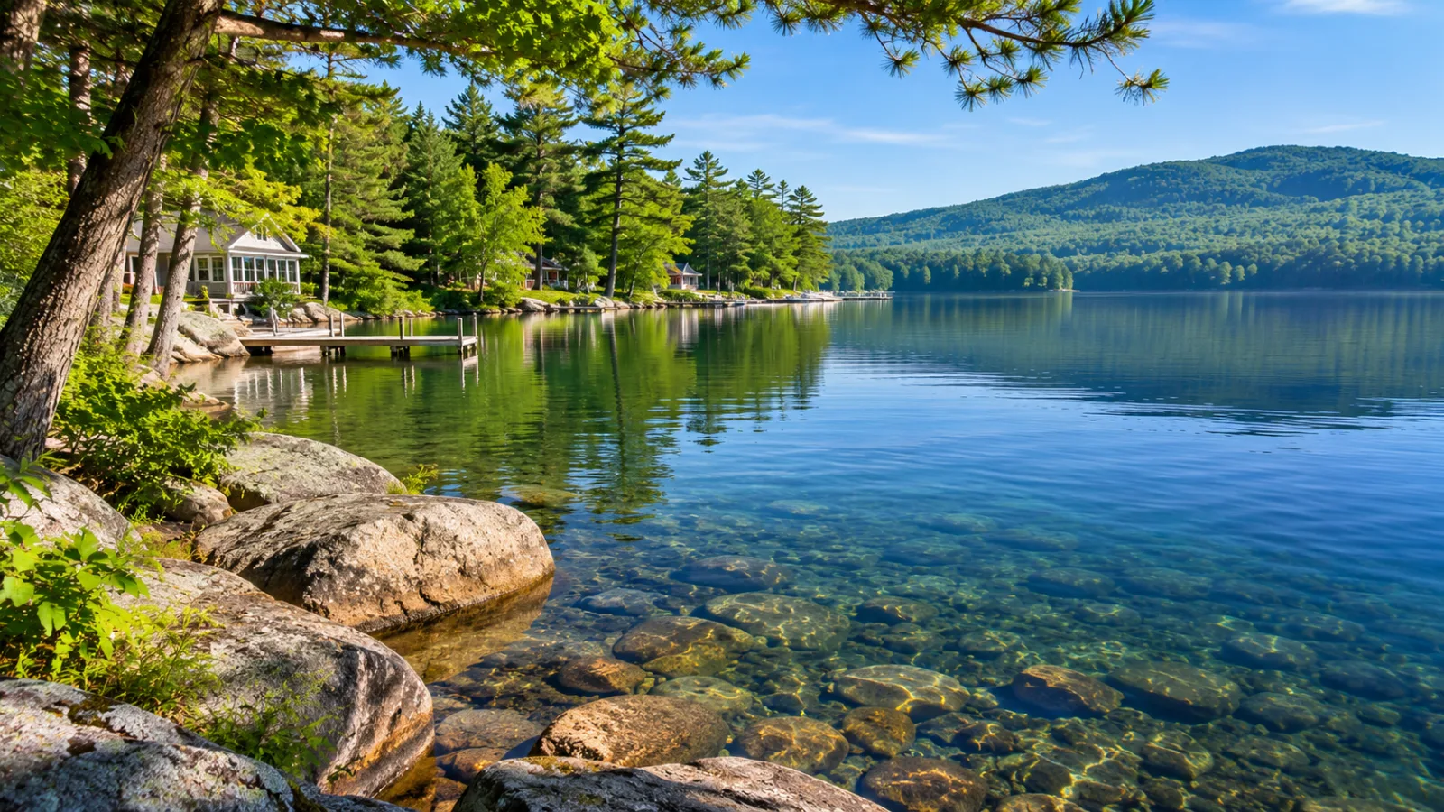
This guide covers what the lake is, how you get on it, and what New Durham's rules mean for owning or renting there. For the live inventory, use the New Durham homes for sale page.
Key takeaways
- Size and depth: 1,233 acres in the state's 2026 fishing digest; 136 feet maximum and 49.8 feet average depth per UNH. Many websites repeat 120 feet.
- Where: entirely in the town of New Durham, Strafford County, ZIP 03855. Its outlet, the Merrymeeting River, runs 10 miles to Lake Winnipesaukee at Alton Bay.
- Clarity: 9.3 meters on average at the Broad Cove station in 2025, with total phosphorus of 4.6 parts per billion, both in the best (oligotrophic) class.
- Public access: a NH Fish and Game trailer ramp on Merrymeeting Road. The New Durham Town Beach beside it is limited to residents, taxpayers, renters and accompanied guests.
- The dam: the NH DES Dam Bureau rates Merrymeeting Lake Dam in poor condition and has chosen a $6.79 million rebuild that would lower the lake about 20 feet for an estimated 18 months, not before some time after 2029.
- Owning and renting: New Durham requires a 75-foot building setback and a 125-foot leach field setback, and prohibits rentals of less than seven days. The 2025 tax rate was $14.14 per $1,000.
In this guide
- Merrymeeting Lake at a glance
- Where is Merrymeeting Lake? New Durham, NH 03855
- How big and how deep is Merrymeeting Lake?
- How clear is the water in Merrymeeting Lake?
- Is Lake Merrymeeting, NH open to the public? The boat ramp and the town beach
- What are the boating rules on Merrymeeting Lake?
- What fish are in Merrymeeting Lake?
- Who looks after the lake?
- Is Merrymeeting Lake going to be lowered? The dam project
- What is the town of New Durham, NH like for an owner?
- What are the rules for building on or changing a Merrymeeting Lake property?
- How do Merrymeeting Lake rentals work?
- What is the property tax rate in New Durham, and how does it compare?
- What should you check before buying on Merrymeeting Lake?
- Frequently asked questions
Merrymeeting Lake at a glance
| Fact | Merrymeeting Lake | Source |
|---|---|---|
| Town, county, ZIP | New Durham, Strafford County, 03855 | Wikipedia |
| Surface area | 1,233 acres (UNH: 1,230) | NH fishing digest, 2026 |
| Maximum depth | 136.0 feet | UNH Lakes Lay Monitoring Program |
| Average depth | 49.8 feet | UNH Lakes Lay Monitoring Program |
| Length and width | About 3.1 by 1.3 miles | Wikipedia |
| Surface elevation | 647 feet | Wikipedia |
| 2025 water clarity | 9.3 meters average (range 7.0 to 10.5) at Broad Cove | UNH 2025 highlights |
| Outlet | Merrymeeting River, to Lake Winnipesaukee at Alton Bay | Wikipedia |
| Public boat access | NH Fish and Game ramp, Merrymeeting Road | State access map |
| Dam | Built 1924, owned by NH Fish and Game | NH DES Dam Bureau |
Links: 2026 digest; UNH 2025 sampling highlights; Wikipedia; state access map; Dam Bureau update, December 2025.
Where is Merrymeeting Lake? New Durham, NH 03855
Merrymeeting Lake is in the northern part of New Durham, a Strafford County town of 2,693 people (2020 census) whose ZIP code is 03855 (Wikipedia). The whole lake is inside New Durham. It is often advertised alongside Alton, the next town west, but no part of the shore is in Alton, and the town line between the two is also the line between Strafford and Belknap counties. Vacation listings labelled "Merrymeeting Lake" are worth checking the same way: confirm the address is in New Durham.
New Durham covers 43.8 square miles, 2.6 of them water. It borders Alton, Wolfeboro, Brookfield, Middleton, Farmington, Strafford and Barnstead, and Route 11 serves it. The north of town, with the lake, drains through the Merrymeeting River to Winnipesaukee; the south drains through the Cocheco and Ela rivers toward the coast.
The town's zoning ordinance names the hills that face the lake: Mount Eleanor, Birch Ridge, Mount Jesse, Devil's Den Mountain, Caverly Mountain, Owl's Head, Mount Bet and Mount Molly. Per Wikipedia, North Shore Road and South Shore Road, both town-maintained, nearly encircle the water, the dam and the Powder Mill Fish Hatchery are at the west end, and two stretches of shore are undeveloped: the steep west side of Sawtooth Cove and the far eastern shore.
How big and how deep is Merrymeeting Lake?
Merrymeeting Lake covers 1,233 acres according to the 2026 NH freshwater fishing digest, and the UNH Lakes Lay Monitoring Program lists a maximum depth of 136.0 feet, an average depth of 49.8 feet and a surface area of 1,230 acres on the lake map in its 2025 sampling highlights. The same figures are on the map in the program's 2019 report.
Other figures are in circulation. Wikipedia gives a maximum depth of 120 feet and an average of 29 feet without citing a source, and that 120-foot figure is the one most websites repeat. Some sites give a smaller area; the state's fishing digest figure is 1,233 acres. Wikipedia is also our only source for the lake's length (3.1 miles), width (1.3 miles) and elevation (647 feet).
Either way it is a deep lake for its size. It ranks seventh in our roundup of the best lakes in New Hampshire for owning on the water, and the big lake it drains into is covered in our Lake Winnipesaukee guide. For a contour chart of the bottom, see where to find NH lake depth maps.
How clear is the water in Merrymeeting Lake?
Merrymeeting Lake's water clarity averaged 9.3 meters, about 30 feet, at the Broad Cove station in 2025, with readings from 7.0 to 10.5 meters between June 3 and October 7. That is the Secchi disk depth, the depth at which a black-and-white disk lowered from a boat disappears from view. The NH DES criteria used in the report put anything deeper than 4.0 meters in the oligotrophic class, the clearest of three (UNH 2025 sampling highlights).
| Measure (2025 seasonal average) | Merrymeeting Lake, Broad Cove | Oligotrophic threshold |
|---|---|---|
| Water clarity (Secchi depth) | 9.3 m (range 7.0 to 10.5) | Deeper than 4.0 m |
| Chlorophyll a | 1.1 ppb (0.4 to 1.7) | Below 3.3 ppb |
| Total phosphorus | 4.6 ppb (3.1 to 8.6) | Below 8.0 ppb |
| Dissolved oxygen in the deep water (measured July 29, 2025) | 10.1 ppm (4.8 to 11.9) | Above 5.0 ppm |
| Specific conductivity (single reading) | 55.6 µS/cm | Below 50 is typical of minimally impacted NH lakes |
The record is long: the lake has been sampled since 1981, and the Merrymeeting Lake Association says testing is done every two weeks in season (MMLA). The 2019 report found a trend of increasing clarity over the 1981 to 2019 record alongside a trend of increasing total phosphorus. The lake is not untouched: the 2025 conductivity reading sits just inside the band the report describes as "lakes with some human influence". The 2025 report's inter-site table gives a different Broad Cove average (10.5 meters) from its headline table; the 9.3-meter headline figure matches the report's own map, so that is the one used here.
A town ordinance applies at the water's edge: since May 1, 2003, it has been unlawful to use or deposit soaps, detergents, cleaning agents or petroleum products in any public water in New Durham, with a $250 civil forfeiture (Public Waters ordinance).
Is Lake Merrymeeting, NH open to the public? The boat ramp and the town beach
Yes. Merrymeeting Lake has one public boat launch, a NH Fish and Game trailer ramp on Merrymeeting Road at the west end of the lake, near the dam and the hatchery. The state's public-access map shows two sites side by side there: the NHFG trailer ramp and the New Durham Town Beach, which the map marks "Residents only" (NH public water access map).
The state ramp. NH Fish and Game describes the site as a public boat access facility with a ramp, a parking area and a shore bank (NH Fish and Game, October 2025). The department closed it for a day in October 2025 to remove hazardous trees, so check for notices before a long drive. The Merrymeeting Lake Association pays for lake hosts who inspect boats at the launch for invasive species (MMLA). The region's other public ramps are in our NH boat launches guide.
The New Durham Town Beach. The beach is run by the town's Parks and Recreation department under the Town Beach Ordinance, in effect since August 3, 2010:
| Rule | New Durham Town Beach |
|---|---|
| Who may use it | Residents, taxpayers, renters, and guests accompanied by a resident or taxpayer |
| Parking | Only vehicles showing a valid Town of New Durham Solid Waste Facility permit, or other identification the town requires |
| Boats | No launching, beaching or placing of any watercraft from the beach property |
| Hours | Closed between 9:00 p.m. and 7:00 a.m. |
| Not allowed | Alcohol, glass containers, fires and portable grills, pets (Seeing Eye dogs excepted), soap in the water, feeding ducks |
| Children | Under 10 must be with an adult |
| Penalty | $100 civil forfeiture for a first offense, $250 for each one after |
Where can the public swim? The New Durham Town Beach is limited to residents, taxpayers, renters and accompanied guests, and NH Fish and Game does not allow swimming at its boat ramps, so the two sites on the state's access map offer no swimming for a visitor with no tie to the town. Ask the town office at 4 Main Street, (603) 859-2091, how the parking permit is issued to a new owner or a seasonal tenant.
What are the boating rules on Merrymeeting Lake?
New Hampshire's statewide boating rules apply on Merrymeeting Lake. The state's boating handbook, New Hampshire Boating Laws and Responsibilities (twelfth edition, 2025), sets out the ones that matter most on a lake this size:
- The 150-foot rule. No faster than headway speed, the slowest speed at which a boat keeps steerage, within 150 feet of swimmers, other vessels, rafts or floats, permitted swimming areas, docks or mooring fields, and the shoreline.
- Who may operate. A motorboat over 25 horsepower needs an operator aged 16 or older who carries a Safe Boater Education Certificate; someone under 16 may operate only with a certificate holder aged 18 or older aboard. At 25 horsepower or less no certificate is required.
- Life jackets. One wearable U.S. Coast Guard-approved life jacket for each person aboard, and children under 13 must wear one while underway unless the boat is enclosed by railings at least three feet high.
The handbook names no rule specific to Merrymeeting Lake. Lake-by-lake restricted areas are set in the state's Marine Patrol rules, so ask NH State Police Marine Patrol about any posted speed or ski restriction before relying on a website's "no restrictions" line. The full statewide table, including the rules for jet skis and towing, is in our post on boating on Lake Winnipesaukee.
What fish are in Merrymeeting Lake?
Merrymeeting Lake is one of the lakes NH Fish and Game manages for lake trout and landlocked salmon, and Wikipedia also lists rainbow trout, smallmouth bass, chain pickerel and horned pout. The department stocks the lake, and the Powder Mill Fish Hatchery sits at the base of the dam, fed by water from the lake (Wikipedia).
The 2026 digest's special rules for Merrymeeting are short (digest). When trolling, only one artificial bait, fly, tandem fly or bait may be used per rod, and only one single-point hook may be used with bait. The digest's general rules for lake trout and salmon lakes apply as well: for 2026, a 15-inch minimum length for lake trout and landlocked salmon, a daily limit of two lake trout, and no taking of trout, lake trout or salmon from October 1 through December 31. Rules change each year; the statewide picture is in our New Hampshire fishing guide.
Who looks after the lake?
Three bodies shape Merrymeeting Lake: the Merrymeeting Lake Association, the land trust that owns much of the hillside above it, and NH Fish and Game, which owns the dam.
The Merrymeeting Lake Association (MMLA). The association funds the lake hosts at the ramp, runs the water testing with UNH, links to a lake-level chart, and in 2023 placed eight defibrillators around the lake. With the Southeast Land Trust of New Hampshire (SELT) it has helped conserve more than 3,500 acres around the lake since 2019, toward a goal of protecting 60% of the watershed by 2027 (MMLA).
Birch Ridge Community Forest. The largest piece of that land is the 2,000-acre Birch Ridge Community Forest, conserved on June 28, 2019 and owned by SELT. About 1,300 of its acres drain to the lake and the river, and it has 13 miles of trails, with trailheads on Merrymeeting Road north of Brackett Road and on Birch Hill Road (SELT).
Is Merrymeeting Lake going to be lowered? The dam project
Yes, eventually. The NH DES Dam Bureau's December 2025 update says rebuilding Merrymeeting Lake Dam will require lowering the lake approximately 20 feet for an estimated 18 months, and that the drawdown and work would likely not begin until some time after 2029.
| Merrymeeting Lake Dam | NH DES Dam Bureau, December 2025 |
|---|---|
| Type and size | Earthen embankment with concrete spillway, 285 feet long, 22 feet high |
| Built | 1924; reconstructed 1969 and 1983 |
| Owner | NH Fish and Game, operated with the NH DES Dam Bureau |
| Rating | High hazard, poor condition |
| Why | Cannot pass the 1,000-year design storm; spillway founded on fill; low-level outlet pipe over 100 years old |
| Chosen fix | "Alternative M2": 50-foot spillway and 8-foot crest gate, estimated $6.79 million |
| Effect on the lake | About 20 feet lower for an estimated 18 months |
| Timing | Likely not before some time after 2029; no start date set |
Eighteen months covers at least one full summer, and a 20-foot drop would move the waterline well away from today's docks. Ask the Dam Bureau for the current schedule before you buy. In an ordinary year the lake is lowered each fall and refills with snowmelt and spring rain, per Wikipedia.
The river below the dam. The Merrymeeting River leaves the lake at 647 feet and runs 10.0 miles through New Durham and Alton to Lake Winnipesaukee at Alton Bay, at 504 feet (Wikipedia). The same update covers two more state-owned dams on it. Jones Pond Dam in New Durham is rated poor, and the selected path is to remove it and restore the river, at a likely $2 million to $2.3 million, pending sediment analysis expected in 2026. Alton Power Dam, downstream, is also rated poor. Where the river ends is in our Alton Bay, NH guide, and the town it crosses is in our guide to the town of Alton.
What is the town of New Durham, NH like for an owner?
The Town of New Durham, NH is a small rural town: 2,693 residents on 43.8 square miles, granted in 1749 as Cochecho Township, settled in 1750 and incorporated on December 7, 1762 (Wikipedia). The New Durham town offices are at 4 Main Street, (603) 859-2091, and the town posts its zoning, building, assessing and beach documents on its website under Documents. Call for current office hours.
Housing stock. New Durham has many more houses than year-round households. The town's 2022 Hazard Mitigation Plan, citing census counts, lists 1,581 housing units in 2020, of which 1,097 were occupied and 484, about 31%, were vacant (Town of New Durham). The census counts a home used seasonally as vacant, and the plan says about 91% of occupied homes were owner-occupied. Wikipedia describes the lake's buildings as mostly simple summer camps in the 1980s, largely replaced by higher-end summer homes in the 1990s. Our guide to camps and cabins in New Hampshire explains how to tell a winterizable camp from a summer-only one.
Frontage or shared access. A listing "on Merrymeeting Lake" can mean owned shore frontage or a right to use a shared access lot. The deed and the recorded plan say which. The town's zoning sets standards for new shorefront common areas, including at least two acres and 150 feet of shore frontage for the first dwelling unit plus 50 feet for each additional one.
Schools. New Durham School is one of the schools of the Governor Wentworth Regional School District, which also runs Kingswood Regional Middle School and Kingswood Regional High School (GWRSD). Confirm school assignment for a specific address with the district.
What are the rules for building on or changing a Merrymeeting Lake property?
A Merrymeeting Lake property answers to two sets of shoreland rules, the state's and New Durham's, and the town's are stricter on setbacks. This is a summary, not legal advice; confirm how the rules apply to a specific lot with the New Durham land use office, NH DES or a New Hampshire real estate attorney.
State law. The Shoreland Water Quality Protection Act (RSA 483-B) governs all land within 250 feet of the water, with a 50-foot primary structure setback and limits on cutting and impervious surface. Since September 1, 2024, RSA 485-A:39 has required a licensed septic evaluation before developed waterfront changes hands when any part of the system is within 250 feet of the water, and a failed system must be replaced within 180 days of transfer. Both are explained in our Lakes Region waterfront guide.
New Durham's Shorefront Conservation Overlay District. Article XIV of the town's zoning ordinance, last amended March 10, 2026, covers land within 300 feet of the normal high-water level of every lake and pond over 10 acres:
| Requirement | New Durham Shorefront Conservation Overlay |
|---|---|
| Building setback from the water | 75 feet for all buildings except water-related structures (state: 50 feet) |
| Leach field setback | 125 feet from the reference line |
| Shore frontage for a waterfront dwelling lot | 150 feet minimum |
| Lot coverage | Buildings no more than 15% of the lot; all impervious surfaces no more than 20% |
| Building height | 35 feet; 12 feet and one story for sheds inside the 75-foot setback |
| Waterfront buffer | Natural buffer within 50 feet of the water |
| Parking for new development | Four spaces, each 9 by 21 feet |
| Nonconforming building | May expand up or down, not closer to the water |
| Demolish and rebuild | Same footprint square footage, foundation and two stories allowed; must move as far back from the water as possible |
| Camp converted to year-round use | A change of use: septic must be certified to current NH DES standards, with room for a replacement system |
| Accessory dwelling unit | Conditional use permit; attached only; four bedrooms in total on a nonconforming lot |
| Duplexes and multi-family | Listed as prohibited uses (section H); section E still mentions duplexes, so confirm with the land use office |
| Recreational vehicles | One per lot, 75 feet from the water; 14 nights a calendar month without a permit |
| Docks | NH DES permit required |
A deviation from these requirements needs a special exception from the Zoning Board of Adjustment. Above the shorefront band, the Merrymeeting Lake Watershed Overlay District (Article XVII) sets a 12-acre minimum residential lot, bars buildings from breaking the skyline and requires shielded outdoor lighting.
How do Merrymeeting Lake rentals work?
Merrymeeting Lake rentals are privately owned homes, and since March 10, 2026 a New Durham ordinance has prohibited renting them for less than seven days. The vacation rentals we manage are in the Waterville Valley and Campton area, not in New Durham, so this section explains the rules and offers no inventory.
The one-page Town of New Durham Short-Term Rental Ordinance defines a short-term rental as the rental of a dwelling unit, or part of one, for seven or more and no more than 30 consecutive days. It prohibits rental periods of less than seven days in all zoning districts, and it permits short-term rentals by special exception wherever residential housing is permitted.
| If you are | What the documents say |
|---|---|
| A guest | Seven nights is the shortest stay the ordinance allows; a weekend rental is prohibited |
| A guest who wants the beach | Renters are among those admitted to the town beach; parking needs the town permit or other identification the town requires |
| A guest with a boat | Launch at the NH Fish and Game ramp; no watercraft may be launched or beached at the town beach |
| An owner or buyer planning to rent | A rental of seven to 30 days needs a special exception from the Zoning Board of Adjustment |
| A buyer of a home already rented | The ordinance is silent on rentals that existed before March 2026; ask the land use office in writing whether the property has a special exception |
| Anyone planning around 2030 and later | The dam rebuild would lower the lake about 20 feet for an estimated 18 months |
The state's Meals and Rooms (Rentals) Tax applies on top. As our answer on whether you need a license to rent out your house in NH sets out, an owner needs an operator's license from the NH Department of Revenue Administration before the first booking, and the 8.5% tax applies to stays shorter than 185 consecutive days. Other towns' ordinances are compared in NH short-term rental rules by town, and the regional rental season is in our Lakes Region vacation rentals guide.
What is the property tax rate in New Durham, and how does it compare?
New Durham's 2025 property tax rate was $14.14 per $1,000 of assessed value, set on November 26, 2025, per the NH Department of Revenue Administration. The rate is the sum of four lines: $3.95 municipal, $1.79 Strafford County, $7.48 local education and $0.92 state education.
| Town | 2025 total rate per $1,000 (NH DRA) |
|---|---|
| Wolfeboro | $8.36 |
| Brookfield | $13.15 |
| Alton | $13.50 |
| New Durham | $14.14 (Copple Crown village district: $17.54) |
| Farmington | $15.64 |
| Middleton | $15.79 (Sunrise Lake village district: $15.89) |
| Barnstead | $17.15 |
| Strafford | $20.96 |
As a worked example only, a property assessed at $500,000 would have carried a 2025 bill of $7,070 in New Durham ($500,000 divided by 1,000, times $14.14), against $6,750 at Alton's rate and $4,180 at Wolfeboro's. The Copple Crown rate applies only inside that village district; the tax bill shows whether a parcel is in it. A rate is only half the bill, so ask for the actual tax bill on any property you are considering. Our NH property taxes explained guide shows how to compare two towns fairly.
What should you check before buying on Merrymeeting Lake?
Six checks follow from the documents cited above.
- The dam schedule. Get the current timeline from the NH DES Dam Bureau and ask how an 18-month, 20-foot drawdown would affect the specific frontage.
- Setbacks and the footprint. Measure the house against the 75-foot setback; whether it is nonconforming decides what you can rebuild.
- The septic system. Order the RSA 485-A:39 evaluation early, and check the leach field against the town's 125-foot setback and the room for a replacement.
- Seasonal or year-round. Ask whether a camp has been approved for year-round use; conversion is a change of use that needs septic certification.
- Rental plans. Confirm the special exception status with the town before you count on rental income, and plan around seven-night minimum stays.
- Frontage and water level. Read the deed for owned frontage or shared access, and ask how much water is at the end of the dock in late summer.
Our buyer services page explains how we work with lake buyers, and you can contact our team with questions. To see what else is listed in the region, browse Lakes Region homes for sale.
About this guide. Owl's Nest Real Estate is based in Campton, at I-93 exit 28, with a second office in Plymouth. Merrymeeting Lake is at the southeastern edge of the Lakes Region, well over an hour's drive from our offices by our estimate, so this guide is built from the town's ordinances, state agency documents and university monitoring reports, not from daily presence on the lake.
Frequently asked questions
What town is Merrymeeting Lake in?
Merrymeeting Lake is entirely in the town of New Durham, New Hampshire, in Strafford County, with the ZIP code 03855. The lake is often mentioned alongside Alton, the next town to the west, but none of its shore is in Alton. Its outlet, the Merrymeeting River, flows 10 miles through New Durham and Alton to Lake Winnipesaukee at Alton Bay.
How deep is Merrymeeting Lake NH?
Merrymeeting Lake NH has a maximum depth of 136.0 feet and an average depth of 49.8 feet, according to the lake map in the UNH Lakes Lay Monitoring Program's 2025 report. Wikipedia and many other websites give 120 feet and a 29-foot average without a source. The state's 2026 fishing digest lists the lake at 1,233 acres.
How clear is Merrymeeting Lake?
Merrymeeting Lake's water clarity averaged 9.3 meters, about 30 feet, at the Broad Cove station in 2025, according to the UNH Lakes Lay Monitoring Program, with readings between 7.0 and 10.5 meters. Total phosphorus averaged 4.6 parts per billion and chlorophyll a 1.1 parts per billion. All three fall in the oligotrophic class, the clearest of the three NH DES categories.
Is there a public boat launch on Merrymeeting Lake?
Yes. NH Fish and Game maintains a public trailer boat ramp with a parking area on Merrymeeting Road in New Durham, at the west end of Merrymeeting Lake near the dam. Swimming is not allowed at Fish and Game ramps. The Merrymeeting Lake Association funds lake hosts who inspect boats there for invasive species. It is the only boat launch the state's public access map shows on the lake.
Can anyone swim at the New Durham Town Beach?
No. The New Durham Town Beach on Merrymeeting Lake is limited by town ordinance to residents, taxpayers, renters, and guests accompanied by a resident or taxpayer. Parking requires a valid Town of New Durham Solid Waste Facility permit or other identification the town requires. The beach is closed from 9:00 p.m. to 7:00 a.m., and boats may not be launched from it.
Can you rent a house on Merrymeeting Lake for a weekend?
Not under the current ordinance. New Durham's Short-Term Rental Ordinance, adopted March 10, 2026, prohibits short-term rentals with rental periods of less than seven days in all zoning districts. Rentals of seven to 30 consecutive days are allowed by special exception where residential housing is permitted. New Hampshire's 8.5% Meals and Rooms (Rentals) Tax applies to those stays.
Is Merrymeeting Lake going to be drained?
Not drained, but lowered. The NH DES Dam Bureau's December 2025 update says rebuilding Merrymeeting Lake Dam, rated in poor condition, will require lowering the lake approximately 20 feet for an estimated 18 months. The chosen design is estimated at $6.79 million, and the update says the drawdown and work would likely not begin until some time after 2029.
What is the property tax rate in New Durham, NH?
New Durham's 2025 property tax rate was $14.14 per $1,000 of assessed value, per the NH Department of Revenue Administration: $3.95 municipal, $1.79 county, $7.48 local education and $0.92 state education. That is higher than Alton ($13.50) and Wolfeboro ($8.36) and lower than Farmington ($15.64), Middleton ($15.79) and Barnstead ($17.15).
How far back from the water do you have to build on Merrymeeting Lake?
New Durham's Shorefront Conservation Overlay District requires all buildings except water-related structures to sit at least 75 feet back from the reference line, which is stricter than the state's 50-foot primary structure setback under RSA 483-B. Leach fields must be at least 125 feet back. Existing closer structures can be rebuilt on the same footprint square footage but must move as far back as possible.