

The town of Alton, NH is the Belknap County town at the southern end of Lake Winnipesaukee, with 5,894 residents at the 2020 census on 83.2 square miles (Wikipedia). It has two ZIP codes, 03809 for Alton and 03810 for Alton Bay, three villages (Alton, Alton Bay and West Alton), and a 2025 property tax rate of $13.50 per $1,000.
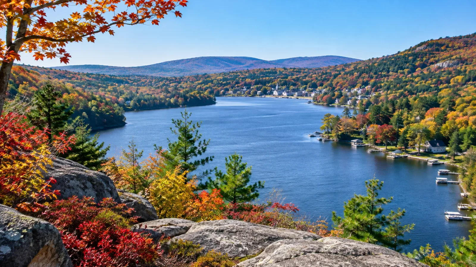
This guide covers the villages, each lake and pond, how the Rattlesnake Island Association works, how the tax rate compares and what to check before you buy. We sell homes around Lake Winnipesaukee and across the Lakes Region; the live inventory is on the Alton NH homes for sale page.
Key takeaways
- One town, two ZIP codes: 03809 for Alton and 03810 for Alton Bay, with one tax rate and one school system.
- Water: Lake Winnipesaukee (Alton Bay, Roberts Cove, the West Alton shore and Rattlesnake Island), Hills Pond (138 acres per NH DES), Sunset Lake and Halfmoon Lake (283 acres, shared with Barnstead). Merrymeeting Lake is in New Durham.
- Rattlesnake Island: 186 privately owned shoreline lots reached only by boat. Since August 1, 2026 a buyer pays the Rattlesnake Island Association a $3,500 buy-in fee, and renters may not use the association's mainland ramp or parking.
- 2025 tax rate: $13.50 per $1,000, the highest of the eight Winnipesaukee towns but below Barnstead ($17.15) and New Durham ($14.14), per the NH Department of Revenue Administration (DRA).
In this guide
- Alton, NH at a glance
- Where is Alton, NH?
- What are the villages in the town of Alton?
- Alton vs. Alton Bay
- Which lakes and ponds are in Alton, NH?
- Rattlesnake Island, Alton NH: how does owning on the island work?
- How long is the Mount Major hike, and where do you park?
- Alton Town Beach, Railroad Square Park and the boat ramps
- How did Alton begin?
- What schools serve Alton, NH?
- Alton, NH property taxes: the 2025 rate compared
- What kinds of homes are in Alton?
- What should you check before buying waterfront in Alton?
- Should you rent or buy in Alton?
- Frequently asked questions
Alton, NH at a glance
| Fact | Alton, New Hampshire |
|---|---|
| County | Belknap (county seat: Laconia) |
| ZIP codes | 03809 (Alton), 03810 (Alton Bay) |
| Population | 5,894 (2020 census) |
| Area | 83.2 sq mi total; 63.7 land, 19.5 water |
| Villages | Alton (the town center at Routes 11 and 140), Alton Bay, West Alton |
| Lakes and ponds | Lake Winnipesaukee, Hills Pond, Sunset Lake, Halfmoon Lake (shared with Barnstead) |
| Highest points | Straightback Mountain north peak, 1,910 ft; Mount Major, 1,786 ft |
| Main roads | NH 11, NH 11A, NH 28, NH 28A, NH 140 |
| 2025 tax rate | $13.50 per $1,000 (NH DRA) |
| Incorporated | January 15, 1796, formerly New Durham Gore |
Geography and census figures are from Wikipedia; Mount Major's elevation is from its own entry; the tax rate is the 2025 total from NH DRA.
Where is Alton, NH?
Alton is in Belknap County, New Hampshire, at the southern end of Lake Winnipesaukee. The town is bordered by Wolfeboro to the north, New Durham to the east, Barnstead to the south, Gilmanton to the southwest, Gilford to the west and Tuftonboro across the water to the northwest (Wikipedia). The New Durham line is also the Strafford County line.
Five state routes meet in Alton. Route 11 runs along the west shore of Alton Bay toward Gilford and Laconia, Route 28 runs north to Wolfeboro with Route 28A as the old shore road up the bay's east side, Route 140 heads west toward Gilmanton and Interstate 93, and Route 11A leaves Route 11 at West Alton for Gilford. By our estimate the town center is roughly 30 to 45 minutes from Laconia or Concord and about two hours from Boston, depending on season and route.
The mailing address for most of the town is Alton, NH 03809, whether the house is on a Route 140 farm or a Winnipesaukee cove, so read the tax card and the plat, not the postal line, to learn which lake a property is on. The town's annual reports, budgets included, are digitized in the UNH Scholars Repository.
What are the villages in the town of Alton?
The town of Alton has three named villages, Alton village, Alton Bay and West Alton, plus the Route 28 side of town toward Wolfeboro and New Durham. They differ in whether they face the bay, the open lake or neither.
| Part of town | Where it is | What is there |
|---|---|---|
| Alton village | Routes 11 and 140, about a mile south of the lake | Main Street, the town offices, the public library, Alton Central School, older village homes and newer subdivisions |
| Alton Bay | Head of the 4-mile bay, where Routes 11 and 28A meet | The bandstand, the town docks, Railroad Square Park, the marinas and its own post office (03810) |
| West Alton | Route 11 on the lake's western shore, at the Route 11A split | Riley Road Beach, West Alton Marina, Winnipesaukee frontage and water-access neighborhoods facing the open lake |
| Route 28 side | Routes 28 and 28A toward Wolfeboro and New Durham | Roberts Cove, East Side Drive, Alton Town Beach and rural roads climbing from the lake |
The Merrymeeting River, the main inlet of Alton Bay, runs through Alton village (Wikipedia).
Alton vs. Alton Bay
Alton Bay is a village inside the town of Alton, not a separate town, so it has Alton's tax rate, zoning and schools but its own ZIP code, 03810 (Wikipedia). Alton Bay is the summer village built around the town docks, the bandstand and the marinas, while Alton village keeps the year-round services, the town offices and the school.
The bay is also where the town's best-known events happen:
- The Alton ice runway on the frozen bay is the only officially recognized seasonal ice runway in the contiguous United States, and it opened for the 2026 season on January 31 (AOPA).
- The Alton winter carnival 2026, sponsored by the Alton Business Association, was held on the bay on Sunday, February 15 (Visit NH).
- The Alton NH fireworks 2026 were set off at the Alton Bay bandstand on Friday, July 3 (Lakes Region events calendar).
The runway's FAA record, the seaplane base and the bay's waterfront-versus-village price logic are in our Alton Bay, NH guide.
Which lakes and ponds are in Alton, NH?
Alton's waters are Lake Winnipesaukee, Hills Pond, Sunset Lake and Halfmoon Lake, the last shared with Barnstead. Merrymeeting Lake, which Alton listings often mention, is in New Durham.
| Lake or pond | Town(s) | Size | Max depth | Notes |
|---|---|---|---|---|
| Lake Winnipesaukee | Alton and seven other towns | 71 sq mi | 180 ft | Alton holds the southern end: Alton Bay, Roberts Cove, the West Alton shore and Rattlesnake Island |
| Hills Pond | Alton | 138 acres (NH DES); 93 acres on lake-listing sites | About 42 ft (12.8 m) | Alton Shores Association beaches; adjoins Sunset Lake |
| Halfmoon Lake | Barnstead and Alton | 283 acres | 27 ft | Warmwater fishery |
| Merrymeeting Lake | New Durham (not Alton) | 1,233 acres | 120 to 136 ft, by source | Its river is Alton Bay's main inlet |
Sources: Winnipesaukee figures from our Lake Winnipesaukee guide; Hills Pond from the NH DES 2020 Volunteer Lake Assessment report for Hills Pond, Alton; Halfmoon Lake and Merrymeeting Lake from Wikipedia (Halfmoon, Merrymeeting); Merrymeeting's 136-foot depth is from UNH's lake monitoring reports, cited in our Merrymeeting Lake guide.
Lake Winnipesaukee. Alton's share of the big lake is the 4-mile Alton Bay, the coves along Routes 28 and 28A, the West Alton shore facing the Broads, and the islands off that shore. Everything listed around the lake is on the Lake Winnipesaukee homes for sale page.
Hills Pond, Alton NH. Hills Pond is the mid-sized lake inland from the bay. The NH DES 2020 report lists a surface area of 138 acres and a mean depth of 5.5 meters (about 18 feet), while lake-listing sites quote 93 acres and 40 feet, so treat the pond as roughly 90 to 140 acres depending on the source.
Hills Pond and Sunset Lake, next to it, are the two waters of the Alton Shores Association, where MLS listings describe deeded rights to association beaches on both. The number of beaches and the annual dues differ from one listing to the next, so read the bylaws, dues history and road-maintenance arrangement before you write an offer. For a depth chart of any Alton water, see where to find NH lake depth maps.
Halfmoon Lake. Halfmoon Lake straddles the Alton–Barnstead line in the south of town, and its fish include largemouth bass, chain pickerel, horned pout and white perch. A Halfmoon Lake address can be in either town, and the two 2025 tax rates differ by $3.65 per $1,000, so confirm which side of the line a camp is on.
Merrymeeting Lake. Merrymeeting Lake lies entirely in New Durham and drains through the Merrymeeting River into Alton Bay. An Alton listing "near Merrymeeting Lake" means a drive, not frontage. New Durham's listings are on the New Durham homes for sale page.
Rattlesnake Island, Alton NH: how does owning on the island work?
Rattlesnake Island is a boat-access island on Lake Winnipesaukee in the town of Alton, with 186 individually owned lots around its shore and an undeveloped interior. Every owner belongs to the Rattlesnake Island Association (RIA), which owns the mainland parking, launch ramp and docks in West Alton that owners use to reach the island (Rattlesnake Island Association).
Rattlesnake Island is the highest island on the lake. It is about 2 miles long and roughly 5 miles around, and its unofficially named summit, Mount Rattlesnake, stands 874 feet above sea level, 370 feet above the water (Wikipedia). The association describes it as the third-largest island on Winnipesaukee. There is no bridge, so owning on the island means owning a boat.
| What a buyer asks | What the Rattlesnake Island Association says |
|---|---|
| Who has to join? | All Rattlesnake Island property owners belong to the RIA, incorporated in New Hampshire on May 12, 1969 |
| What does a buyer pay the association at purchase? | A $3,500 buy-in fee, effective August 1, 2026 ($2,500 for an existing member buying another property) |
| Is there a right of first refusal? | Buyer and seller complete a Waiver of Right of First Refusal, signed by an association director or officer |
| Where do you park and launch? | Two association parcels in West Alton: an upper lot at Route 11 and Rollins Road with a locked trailer storage area, and a waterfront lower lot on Nowicki Point Road with the association launch ramp and docks |
| How many parking permits? | Up to 2 for the upper lot and 2 for the lower lot per island lot; keys cost $50 |
| What does trailer storage cost? | $50 a year for the first trailer tag, $100 for the second, $150 for each tag when there are three or more |
| Can renters use the mainland lots? | No. Renters and non-owners may not use any RIA facility |
Sources: the association's home, mainland and property transfers pages, read in November 2026. Those pages do not publish the annual assessment, so ask the association for the current figure and whether the seller's account is paid up; only members in good standing may use the parking and trailer storage.
Four details on those pages change how a purchase works:
- The seller returns all parking permits, trailer tags and keys to the association before it signs the waiver, and the buyer requests new ones after closing.
- The community dock is for picking up and dropping off guests only, and commercial barges may not load material or equipment at it, so ask a builder how materials would reach the lot.
- The trailer storage area cannot be reached in winter because snow builds up at the gate.
- Renters may not use the association's facilities, so a plan to rent the cottage out needs its own answer for parking and a ride across.
The interior of the island is not for sale. The RIA owns the interior land on the northwest side plus a number of shoreline lots of its own, and the Lakes Region Conservation Trust owns the interior on the southeast side, reached through one designated waterfront lot and dock that is limited to trust members and their guests.
The association's island page says there are no plans to develop the interior, that hiking trails cross the island's highest peak, and that 7 "safe docks" in Young's Cove and 2 in Copeland's Cove serve some individual owners. Wikipedia adds that electricity and wired telephone reach all parts of the island; ask the seller what internet service the lot has.
Beyond the association's rules, check the usual island questions: winter access once the lake freezes, how septic pumping is done, and whether your lender and insurer will write a boat-access property. Our where to buy on Lake Winnipesaukee guide covers the island communities around the lake side by side.
How long is the Mount Major hike, and where do you park?
The Mount Major hike is 1.5 miles to the summit by the main trail, starting from a parking lot on Route 11 about 4.2 miles north of Alton Bay. Mount Major is a 1,786-foot summit in Alton, in the Belknap Mountains, with an open, rocky top that looks up the length of the lake (Wikipedia). Three trails leave from the Route 11 lot:
| Trail | Blaze | Distance to the summit |
|---|---|---|
| Mount Major Trail | Blue | 1.5 miles |
| Boulder Loop | Orange | 1.6 miles |
| Brook Trail | Yellow | 1.7 miles |
The Society for the Protection of New Hampshire Forests owns and manages a 200-acre conservation area on the mountain, and those distances are from its Mount Major page. The upper ledges are steep and can be dangerous when wet or icy, and the Forest Society suggests the Brook Trail in those conditions.
The Belknap Range, running west from Mount Major toward Gunstock in Gilford, is why so many Alton homes on the Route 11 side have a view: the land climbs fast from the lake. How assessors and appraisers price that is in our guide on whether a view increases home value.
Alton Town Beach, Railroad Square Park and the boat ramps
Alton has two town beaches, Alton Town Beach on Route 28A and Riley Road Beach on Route 11, a waterfront park with a town ramp at Railroad Square, and a free state launch at Downing's Landing, all on Lake Winnipesaukee.
Alton Town Beach is on East Side Drive (Route 28A), on the east shore of Alton Bay. The town's parks list describes a raised beach, a covered picnic area, swimming, a seasonal lifeguard, benches and seasonal restrooms (Town of Alton, Parks and Facilities). Riley Road Beach, on Route 11 at Riley Road in West Alton, has a deck and limited parking, per the same list. Check any sticker or fee rules with Alton Parks and Recreation before your first summer.
Railroad Square Park is the waterfront park at the head of the bay, next to the Alton Bay Community Center on Route 11. The town lists a swim dock, a seasonal lifeguard, benches, picnic tables, a boat launch ramp and boat docks there.
Boat ramps. Downing's Landing, at the southern tip of Alton Bay, is NH Fish and Game's free trailered launch on Lake Winnipesaukee, with a double ramp and a paved lot that is first come, first served; the town ramp at Railroad Square Park is the second public launch. Both are in our NH boat launches guide, and the other Winnipesaukee ramps and their fees are in our post on boating on Lake Winnipesaukee.
Marinas and camping. Parker Marine in Alton Bay, New Hampshire, at 381 Main Street, is a full-service marina with seasonal slips, boat sales, fuel and winter storage (Marinas.com); West Alton Marina serves the Route 11 shore. If a slip sits inside the Alton Bay bridge, check your boat's height against the clearance before you sign a slip contract. Viewland Campground, at 6 Viewland Court in Alton, NH, has 56 approved campsites on about 9.3 acres and was listed for sale in July 2026, per its MLS listing, so confirm it is operating before you plan a season there.
How did Alton begin?
Alton was settled in 1770 as New Durham Gore, incorporated on January 15, 1796, and named for Alton, a market town in Hampshire, England (Wikipedia). The Cochecho Railroad from Dover reached Alton Bay in 1851 and made the village the end of the line, where rail passengers met the lake steamers; the line ran until 1935 (Wikipedia: Alton Bay).
The original steamer Mount Washington was launched at Alton Bay in 1872, and the bay has been a port of call for her and her successors since. The M/S Mount Washington stopped calling at Alton Bay for a time because of a problem with the stern cluster, the deep-water pilings off the dock that the ship rests against, and the operator announced a return to Alton Bay on August 9, according to Mount Washington Cruises; check the operator's schedule before you plan around a stop.
The Alton Bay Christian Conference Center is the other institution the railroad brought. The first Second Advent camp meeting opened on the bay on September 7, 1863, and the association was incorporated in 1876; it now runs year-round as a retreat and conference center (Alton Bay Christian Conference Center). The center says more than 100 privately owned cottages stand on its grounds, and it publishes a tenancy application for them. Ask for its tenancy terms in writing before you compare one of those cottages with a lake house down the road.
What schools serve Alton, NH?
Alton has one school of its own and shares a high school with Barnstead. Alton Central School, on School Street in the village, serves Alton students through grade 8. Prospect Mountain High School, at 242 Suncook Valley Road in Alton, opened in 2004 as the joint high school for Alton and Barnstead; it enrolled 402 students in 2024–25 per NCES, with an 11.1-to-1 student-teacher ratio (Wikipedia). For current enrollment and programs, use the NH Department of Education profiles.
There is no hospital in Alton; the nearest are in Laconia, Wolfeboro (Huggins Hospital) and Rochester, each roughly half an hour away by our estimate.
Alton, NH property taxes: the 2025 rate compared
Alton's 2025 property tax rate was $13.50 per $1,000 of assessed value, per the NH DRA's 2025 municipal tax rates, set on November 14, 2025. The rate is the sum of four lines: $4.09 municipal, $1.51 Belknap County, $6.04 local education and $1.86 state education. Here is how it compares with the towns Alton buyers also look at:
| Town | 2025 total rate per $1,000 (NH DRA) |
|---|---|
| Moultonborough | $5.33 |
| Tuftonboro | $6.40 |
| Wolfeboro | $8.36 |
| Meredith | $10.62 |
| Center Harbor | $11.84 |
| Gilford | $11.85 (Gunstock Acres village district: $12.53) |
| Laconia | $12.98 |
| Alton | $13.50 |
| New Durham | $14.14 (Copple Crown village district: $17.54) |
| Gilmanton | $15.25 |
| Barnstead | $17.15 |
Alton has the highest rate of the eight Winnipesaukee shoreline towns, a little more than twice Tuftonboro's, but a lower rate than Barnstead, Gilmanton and New Durham next door. As an example only, here is the same $600,000 assessment in three towns at the 2025 rates:
| Town | 2025 rate | Tax on a $600,000 assessment |
|---|---|---|
| Alton | $13.50 | $8,100 |
| Gilford | $11.85 | $7,110 |
| Wolfeboro | $8.36 | $5,016 |
A rate is only half the bill and the assessment is the other half, so ask for the actual tax bill on any house you like. Our NH property taxes explained guide shows how to compare two towns fairly.
What kinds of homes are in Alton?
Alton's homes fall into five groups: Winnipesaukee frontage, water-access association homes, village and rural homes, a small condominium and manufactured-home market, and seasonal camps. The group a listing is in decides more about its price and its paperwork than its ZIP code does.
Winnipesaukee frontage. The top of the market is on the big lake: the West Alton shore along Route 11 facing the Broads, the two shores of Alton Bay, the coves off Routes 28 and 28A, and Rattlesnake Island. Roberts Cove, Alton NH, is on the east side of town off Route 28 toward Wolfeboro, several miles up the lake from the Downing's Landing ramp.
Water-access and association neighborhoods. Many more Alton homes have deeded beach rights than have frontage. The Alton Shores Association roads around Hills Pond and Sunset Lake are the clearest case. These homes usually list for less than direct frontage, and the association documents decide what you get: which beach, whether a mooring or dock slot is possible, who plows, and what the dues cover.
Village and rural homes. Alton village has older homes on in-town lots plus newer subdivisions. Beyond it, Routes 140 and 28 and the hill roads hold rural homes on larger lots and land for sale.
Condos and manufactured homes. Alton's condominium market is small; the band below shows what is listed today. Eagle's Rest, Alton NH, on Eagles Way and Osprey Road off Route 28, is a manufactured-home park that MLS listings describe as a 55+ community. Those listings show a monthly park fee covering park rent, plowing, water, sewer and trash, and they note that buyers need park approval. The fee has differed from listing to listing, so get the current fee and the park rules in writing from park management. Park loans and a resident's rights under RSA 205-A are in our guide to mobile and manufactured homes in New Hampshire.
Camps. A camp in Alton, NH, in the New Hampshire sense, is a seasonal cottage, often on a small lake or a water-access lot, and often with a seasonal water supply and an older septic system. Our guide to camps for sale in New Hampshire explains how to tell a winterizable camp from a summer-only one, and our winterizing guide covers the first off-season.
What should you check before buying waterfront in Alton?
Check six things before an offer on any Alton property on Winnipesaukee, Hills Pond, Sunset Lake or Halfmoon Lake. This is a summary of the rules, not legal advice; confirm the details for a specific lot with NH DES, the Town of Alton or a New Hampshire real estate attorney.
- Shoreland permits (RSA 483-B). Under the Shoreland Water Quality Protection Act, the protected shoreland extends 250 feet back from the water. Primary structures must sit at least 50 feet back from the reference line (towns can require more), tree removal in the 50-foot waterfront buffer follows a grid-and-point system, and most new construction, excavation or filling in the zone needs a state shoreland permit from NH DES. Ask for the permit history on any addition, patio or wall you can see.
- The septic evaluation (RSA 485-A:39). Since September 1, 2024, RSA 485-A:39 has required the buyer of developed waterfront property to have the septic system evaluated, at the buyer's expense, by a New Hampshire-licensed septic system evaluator before the transfer when any part of the system lies within 250 feet of the reference line. A buyer may instead accept in writing a seller's evaluation completed within 180 days of the transfer. The findings do not block the sale, but a system found to be in failure must be replaced by the buyer within 180 days of the transfer.
- Docks and moorings. Docks are permitted by NH DES under the wetlands law through its docking structures program. Confirm the dock is permitted, what the permit covers and that it transfers. On Rattlesnake Island, where the association's community dock is for pick-up and drop-off only, ask where the boat will be kept.
- Water depth and ice. Ask how deep the water is at the end of the dock in August, and whether the dock comes out for winter.
- Road, plowing and utilities. Many Alton shore roads are private or association roads. Confirm who plows, whether the road is maintained year-round and whether the water line is seasonal. Our flood insurance answer explains when a lender requires coverage.
- The association file. For Alton Shores, Rattlesnake Island and the water-access neighborhoods, read the bylaws, budget and minutes before the inspection, not after. On Rattlesnake Island, add the $3,500 buy-in fee and the association's signed waiver to the closing list.
Our Lakes Region waterfront guide walks through each of these across the region's lakes.
Should you rent or buy in Alton?
Renting first makes sense when you don't yet know which Alton you want, because the West Alton shore, the bay, the Hills Pond associations and the Route 140 hills are different places to live. Much of what is offered for rent is summer cottages and lake houses let by the week, and an off-season lease on one usually ends before the owner's summer season, so ask about the end date.
If you plan to buy and rent the house out, confirm the current zoning and any registration requirement with the Town of Alton, which sets the short-term rental rules. An association can add its own limits, as the Rattlesnake Island rule on renters shows; our answer on whether an HOA can ban short-term rentals in NH covers how to check them. Our Lakes Region vacation rentals guide explains the Winnipesaukee rental season, and our short-term rental analysis runs the numbers on a specific address.
Our buyer services page explains how we work with lake and in-town buyers; contact our team to set up a day of showings. To compare Alton with its neighbors, read our Gilford buying guide for the Route 11 side and our Wolfeboro real estate guide for the Route 28 side, or browse Lakes Region homes for sale. If you already own in Alton, start with a free home valuation.
Halfmoon Lake feeds Locke Lake in Barnstead, a private association lake covered in our guide to Locke Lake and the lakes of Barnstead and Gilmanton.
Frequently asked questions
What county is Alton, NH in?
Alton, NH is in Belknap County, New Hampshire, whose county seat is Laconia. Alton forms the southern end of Lake Winnipesaukee and borders Wolfeboro, New Durham, Barnstead, Gilmanton, Gilford and Tuftonboro. Its eastern neighbor, New Durham, is in Strafford County, so the Alton town line is also the county line.
What is the ZIP code for Alton, NH?
The ZIP code for Alton, NH is 03809, which covers the town center and most of the town. The village of Alton Bay, about a mile north at the head of the bay, has its own ZIP code, 03810. Both are in the single town of Alton, which sets one property tax rate for everything inside it.
What is the difference between Alton and Alton Bay?
Alton is the 83-square-mile town; Alton Bay is the summer village inside it at the head of the 4-mile bay of Lake Winnipesaukee. Alton village, at Routes 11 and 140, holds the town offices, the library and Alton Central School. Alton Bay holds the bandstand, the town docks, the marinas and, in a cold winter, the ice runway.
Is Rattlesnake Island in Alton, NH?
Yes. Rattlesnake Island on Lake Winnipesaukee is within the town of Alton. The island is about 2 miles long, its summit stands 874 feet above sea level and 370 feet above the lake, and it is the highest island on Winnipesaukee. Its 186 privately owned lots are all on the shore, and the interior belongs to the Rattlesnake Island Association and the Lakes Region Conservation Trust.
How do you get to Rattlesnake Island NH?
Rattlesnake Island NH is reached only by private boat. Owners leave from the Rattlesnake Island Association's two parcels in West Alton: an upper parking lot at Route 11 and Rollins Road, and a waterfront lower lot on Nowicki Point Road with the association launch ramp and docks. Each island lot can get two parking permits for each area, and renters and non-owners may not use the association's facilities.
What does it cost to join the Rattlesnake Island Association?
A buyer of Rattlesnake Island property pays the Rattlesnake Island Association a $3,500 buy-in fee, effective August 1, 2026, or $2,500 if the buyer is already a member, according to the association's property transfers page. The association also signs a Waiver of Right of First Refusal for each sale. Ask the association for the current annual assessment.
How big and how deep is Hills Pond in Alton?
Hills Pond in Alton covers 138 acres, with a maximum depth of 12.8 meters (about 42 feet) and a mean depth of 5.5 meters (about 18 feet), according to the NH DES 2020 Volunteer Lake Assessment report. Lake-listing sites quote 93 acres and 40 feet. Hills Pond adjoins Sunset Lake, and the two are the waters of the Alton Shores Association.
Where is the Alton Town Beach?
Alton Town Beach is on East Side Drive (Route 28A), on the east shore of Alton Bay, with a raised beach, a covered picnic area, a seasonal lifeguard, benches and seasonal restrooms per the town's parks list. Alton's second town beach is Riley Road Beach on Route 11 in West Alton.
What is the property tax rate in Alton, NH?
Alton's 2025 property tax rate was $13.50 per $1,000 of assessed value, per the NH Department of Revenue Administration: $4.09 municipal, $1.51 county, $6.04 local education and $1.86 state education. That was the highest of the eight Lake Winnipesaukee towns (Gilford was $11.85, Wolfeboro $8.36) but lower than inland Barnstead ($17.15) and New Durham ($14.14).